3D
New Map Of Indiana
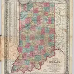
Colton's New Map Of Indiana. Reduced from his Large Map Exhibiting the Boundaries of Counties, Township Surveys, Location of Cities, Towns, Villages, Post Offices, Canals, Rail Roads & other Internal Improvements. New-York, Published by J.H. Colton. 1853.
David RumseyColton, J. H.
1853
1853
J. H. Colton.
1:1 300 000