Cataloged map
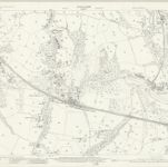
Lancashire XCIII.2 (includes: Orrell; Shevington; Standish With Langtree; Upholland; Wigan) - 25 Inch Map

Institution:National Library of Scotland
Full title:Lancashire XCIII.2 (includes: Orrell; Shevington; Standish With Langtree; Upholland; Wigan) - 25 Inch Map
Depicted:1926
Pubdate:1928
Publisher:Ordnance Survey
Map scale:1:2 500