خريطة مفهرسة
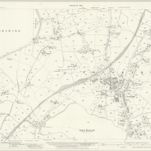
Lancashire XLVIII.12 (includes: Colne; Foulridge; Salterforth) - 25 Inch Map

المؤسسة:National Library of Scotland
العنوان الكامل:Lancashire XLVIII.12 (includes: Colne; Foulridge; Salterforth) - 25 Inch Map
مصورة:1930
تاريخ النشر:1932
الناشر:Ordnance Survey
مقياس الخريطة:1:2 500