Carte cataloguée
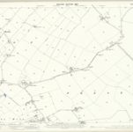
Northumberland (Old Series) LXXXIX.7 (includes: Tynemouth; Whitley And Monkseaton) - 25 Inch Map

Institution:National Library of Scotland
Titre complet:Northumberland (Old Series) LXXXIX.7 (includes: Tynemouth; Whitley And Monkseaton) - 25 Inch Map
Année de l'image:1895
Date de publication:1897
Éditeur:Ordnance Survey
Échelle de la carte:1:2 500