Cataloged map
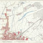
Lancashire CII.3 (includes: Atherton; Leigh) - 25 Inch Map

Institution:National Library of Scotland
Full title:Lancashire CII.3 (includes: Atherton; Leigh) - 25 Inch Map
Depicted:1888 - 1892
Pubdate:1893
Publisher:Ordnance Survey
Map scale:1:2 500