Gecatalogiseerde kaart
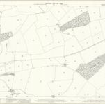
Lincolnshire CXXXI.10 (includes: Burton Coggles; Colsterworth; Corby; Easton) - 25 Inch Map

Instelling:National Library of Scotland
Volledige titel:Lincolnshire CXXXI.10 (includes: Burton Coggles; Colsterworth; Corby; Easton) - 25 Inch Map
Jaar illustratie:1903
Pubdatum:1904
Uitgever:Ordnance Survey
Schaal kaart:1:2 500