Last Monday the project attended the AHRC-moot on Digital Transformations, held at the
Mermaid Conference Centre in London. Humphrey Southall represented Old Maps Online and presented a joint display entitled
'Old Maps and the Spatial turn'. Alongside Old Maps Online, this exhibition included Kate Jones (University of Portsmouth)
who was introducing the new Bomb Sight website/mobile app
(another JISC funded project), Kimberly Kowal (British Library and a member of our steering group) who presented the
BL Georeferencer project on which they collaborated with
Klokan Technologies and Leif Isaksen (University of Southampton) who was presenting
the Pelagios project which links together resources
about the ancient world via a gazetteer of ancient places and YAMA
a historical map annotator. There was also a display about the Georeferencer Metadata Hub from Klokan.

| copyright © 2000 Cartography Associates. |
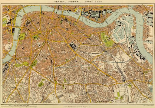
The aim of this joint exhibition was to focus attention on projects working to embed historical maps into modern digital scholarship and exploit the significant general interest there is in old maps. The old map example here was published by Edward Stanford of London in 1901 and shows South East London.
For further information about the day, including a downloadable PDF of the programme see the AHRC website: https://www.ahrc.ac.uk/Funding-Opportunities/Research-funding/Themes/Digital-Transformations/Pages/Digital-Transformations-Moot.aspx

