Gecatalogiseerde kaart
Wiltshire XLIII.2 (includes: Grafton; Shalbourne; Tidcombe and Fosbury) - 25 Inch Map
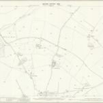

Volledige titel:Wiltshire XLIII.2 (includes: Grafton; Shalbourne; Tidcombe and Fosbury) - 25 Inch Map
Jaar illustratie:1899
Pubdatum:1900
Uitgever:Ordnance Survey
Fysieke grootte:20 x 30 cm
Schaal kaart:1:2 500
Hungerford (Hills) - OS One-Inch Revised New Series
1901
Ordnance Survey
1:63k
Hungerford (Outline) - OS One-Inch Revised New Series
1893
Ordnance Survey
1:63k
The fourth sheet of an actual survey of Berkshire
1761
John Rocque
The fifth sheet of an actual survey of the countys of Berks Oxford and Bucks
1761
John Rocque
SU57 - OS 1:25,000 Provisional Series Map
1938
Ordnance Survey
1:25k
SU56 - OS 1:25,000 Provisional Series Map
1938
Ordnance Survey
1:25k
SU47 - OS 1:25,000 Provisional Series Map
1956
Ordnance Survey
1:25k
SU46 - OS 1:25,000 Provisional Series Map
1956
Ordnance Survey
1:25k
SU37 - OS 1:25,000 Provisional Series Map
1956
Ordnance Survey
1:25k
SU36 - OS 1:25,000 Provisional Series Map
1956
Ordnance Survey
1:25k