Project
Community
News
My App
My maps
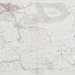
Somerset XVII.NE - OS Six-Inch Map
1929
Ordnance Survey
1:11k
Somerset XVII.NE - OS Six-Inch Map
1902
Ordnance Survey
1:11k
Somerset XVII.NE - OS Six-Inch Map
1883
Ordnance Survey
1:11k
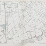
Somerset XVII.3 (includes: Banwell; Winscombe) - 25 Inch Map
1929
Ordnance Survey
1:3k
Somerset XVII.3 (includes: Banwell; Winscombe) - 25 Inch Map
1902
Ordnance Survey
1:3k
Somerset XVII.3 (includes: Banwell; Winscombe) - 25 Inch Map
1884
Ordnance Survey
1:3k
Somerset XVII.7 (includes: Banwell; Winscombe) - 25 Inch Map
1929
Ordnance Survey
1:3k
Somerset XVII.7 (includes: Banwell; Winscombe) - 25 Inch Map
1902
Ordnance Survey
1:3k
Somerset XVII.7 (includes: Banwell; Winscombe) - 25 Inch Map
1884
Ordnance Survey
1:3k
Somerset XVII.11 (includes: Compton Bishop; Winscombe) - 25 Inch Map
1929
Ordnance Survey
1:3k
History
Old maps of Winscombe and Sandford
Discover the past of Winscombe and Sandford on historical maps
Old maps of Winscombe and Sandford
Discover the past of Winscombe and Sandford on historical maps
Explore Maps
Discover History
Parent places
North Somerset
Related places