1926
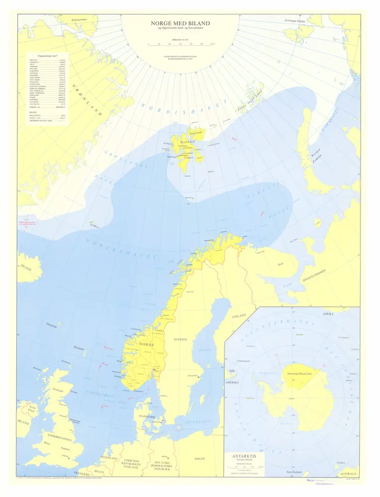
Aamodt , Axel F.
1:2m
1892
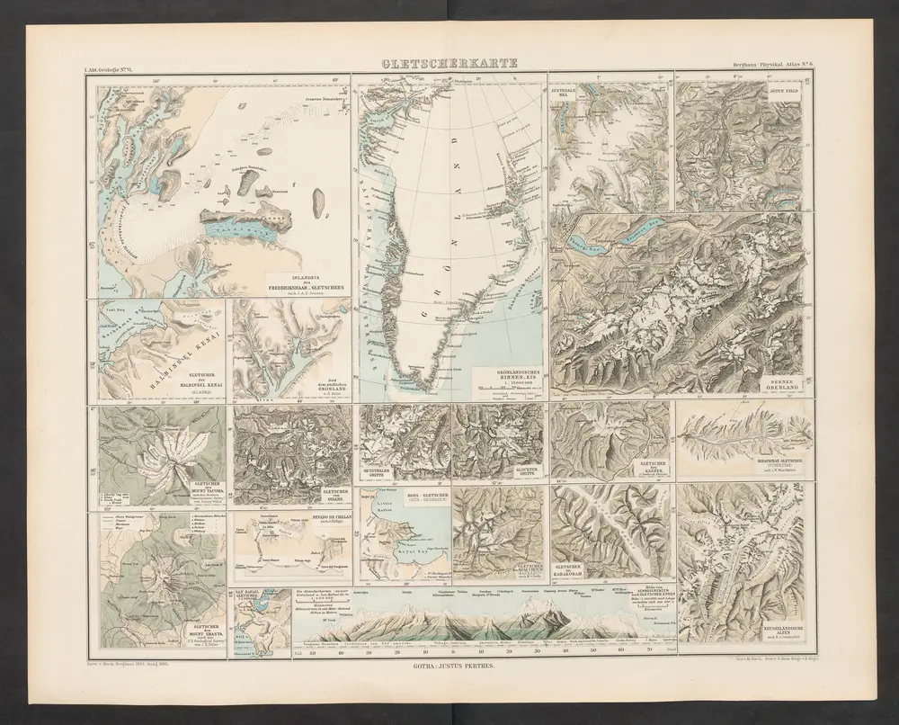
Zittel, K.v. ; Berghaus, Hermann
1959
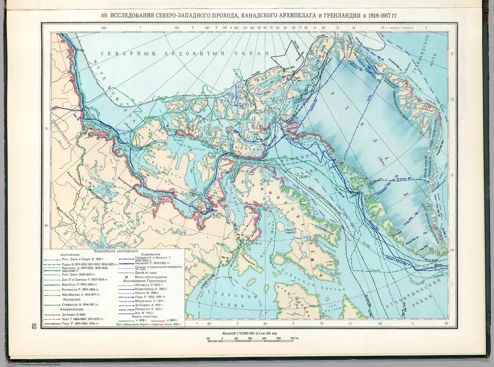
Soviet Union. Glavnoe upravlenie geodezii i kartografii
1952
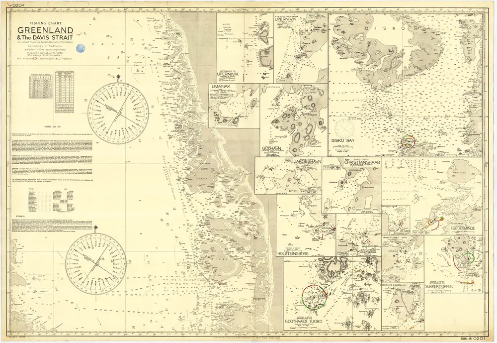
St. Ives, Hunts : Imray, Laurie, Norie & Wilson
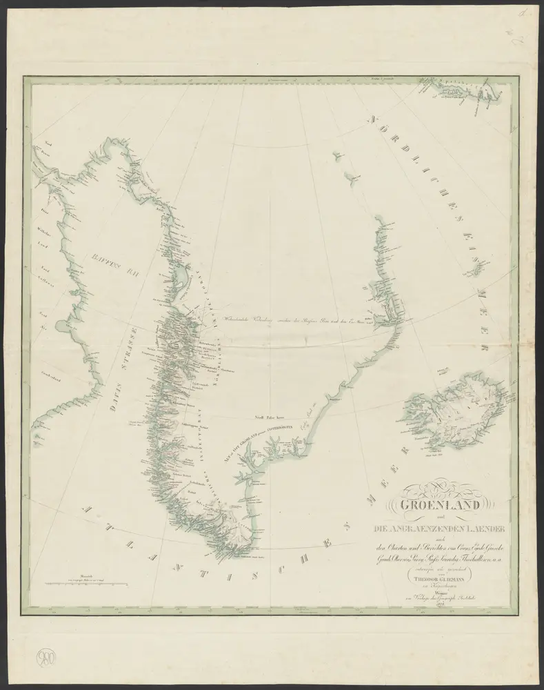
1828
entworfen und gezeichnet von Theodor Gliemann
1:5m
1898
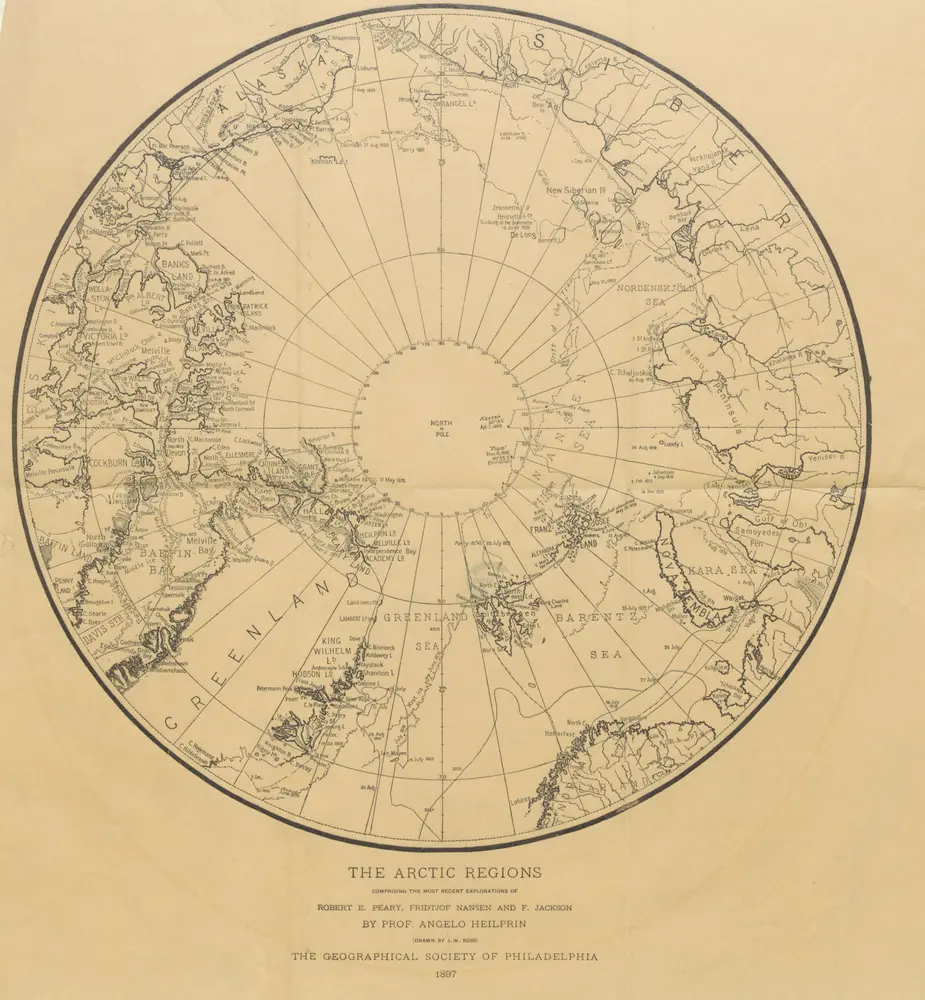
PEARY, Robert Edwin.
1665
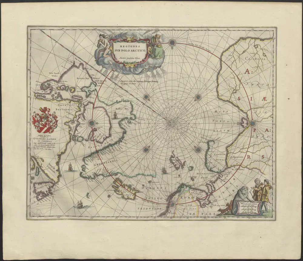
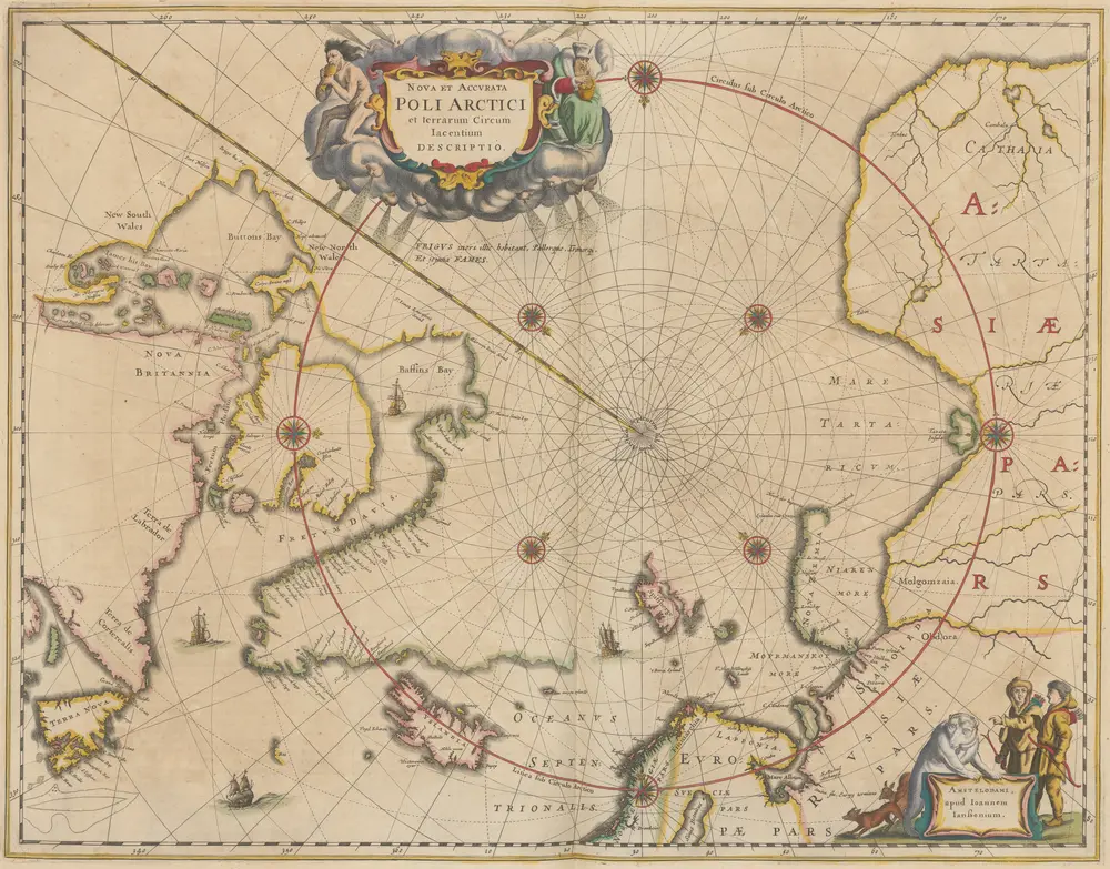
Auctore Guiljelmo Blaeu
1975
Gauss KrÃ1⁄4ger
1:6m
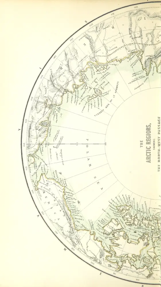
1856
A. Fullarton
1647
Janssonius Offizin