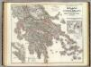
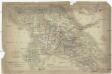
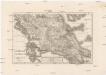
Old maps of Peloponnese, West Greece and Ionian Sea

Discover the past of Peloponnese, West Greece and Ionian Sea on historical maps

Browse the old maps

Discovering the Cartography of the Past

Peloponnese, West Greece and Ionian Sea


Parent places:

Related places:

County

Maps of Peloponnese, West Greece and Ionian Sea

Maps of Peloponnese, West Greece and Ionian Sea

$title$

The Ionian Islands and Malta.

1 : 410000 Arrowsmith, John
$title$

Graeciae antiquae specimen geographicum

1 : 1000000 Řecko Anville, Jean-Baptiste Bourguinon d' Berndt, Johann Christoph Officina Weigelio-Schneideriana
$title$

Greece and the Ionian Islands.

1 : 1584000 Arrowsmith, John
$title$

[Griechenland]

1 : 1000000 Athény (Řecko : oblast)
$title$

Das Königreich Hellas

1 : 1000000 Řecko Bosse, P. Debes, E. Geograph. Anstalt von Wagner & Debes
$title$

Greece and the Ionian Republic.

1 : 1500000 Colton, G.W.
$title$

Graecia, Epirus, post bella Persia.

1 : 1400000 Menke, Th.
$title$

Greece and the Ionian Republic.

1 : 1500000 Colton, G.W.
$title$

Graecia

Schul-Atlas der alten Welt bei Justus Perthes
$title$

Hellas, Ionischen Inseln.

1 : 800000 Kiepert, Heinrich, 1818-1899
$title$

Griechenland mit Beachtung der Klassischen Zeit

Stieler's Hand-Atlas Stieler, Adolf bei Justus Perthes
$title$

$title$

Carte particuliere des Iles Ioniennes et de la Morée

Jónské ostrovy (Řecko) Bocage, Jean-Denis Barbié du Luther, Th.
$title$

Das Königreich Hellas oder Griechenland und die Republik der Seiben Ionischen Inseln (Ephtánisos)

Řecko Kiepert, Heinrich Herzberg, H. Verlag des Geographischen Instituts
$title$

Graecia.

1 : 1250000 Kiepert, Heinrich, 1818-1899
$title$

Morea

Řecko Müller, Jos. D. Šafařík, Pavel Josef
$title$

Hellas

1 : 1680000 Athény (Řecko) Kiepert, Heinrich Kratz, W. Geographisches Institut
$title$

Řecko

starověké Řecko Bodenehr, Gabriel Sharland, William Karel André
$title$

Schul-Atlas für die alte Erdbeschreibung : zur allgemeinen Schul-encyclopädie gehörig

J. H. Campe Zusammensetzung und Zeichnung von [...] Dufour, unter Leitung von Heusinger ; gestochen von Frentzel. Braunschweig : Schulbuchhandlung
$title$

Greece.

1 : 917000 Johnston, Alexander Keith
$title$

Peloponnesus; sive Morea. [Karte], in: Novus atlas absolutissimus, Bd. 10, S. 176.

1 Karte aus Atlas Janssonius Offizin
$title$

Die türkisch-griechischen Grenzgebiete

1 : 600000 Balkánský poloostrov Handtke, Friedrich Carl Flemming
$title$

La Morée Et les Isles de Zante, Cefalonie, Ste. Maure, Cerigo &c. [Karte], in: Atlas nouveau, contenant toutes les parties du monde [...], Bd. 2, S. 233.

1 Karte aus Atlas Sanson, Nicolas Jaillot, Alexis Hubert und Mortier, Pieter
$title$

Greece and the Ionian Islands.

1 : 1110000 Sharpe, J.
$title$

$title$

Griechenland

1 : 2000000 Griechenland
$title$

Epirus, Thessalia et Hellas

Griechenland, Thessalien
$title$

Graeciae

1 : 630000 Řecko Berra, Marco M. Berra
$title$

[Historisch-geographischer Atlas zu den allgemeinen Geschichtswerken von C. v. Rotteck, Pölitz u. Becker] : Alt Griechenland

von Julius Loewenberg [Freiburg im Breisgau] : [Herder]
$title$

Hellas Thessalia Epirus

1 : 800000 Epirus (Řecko) Reichard, Christian Gottlieb Campius, D. a D. Campio
© MapTiler © OpenStreetMap contributors
How does it work?
These instructions will show you how to find historical maps online.
Getting started
Type the place name in the search box to find the exact location. You can further adjust the search by zooming in and out.
Zoom
Zoom in and out with the buttons or use your mouse or touchpad natively.
Exact Area tool
Click here and draw a rectangle over the map to precisely define the search area.
Set filters
Narrow your search with advanced settings, such as Years (from/to), Fulltext, Publisher, etc.
Results
See the results of your search on the right side. You can scroll down to find more maps of this location.
?

Download OldMapsOnline Mobile