Project
Community
News
My maps
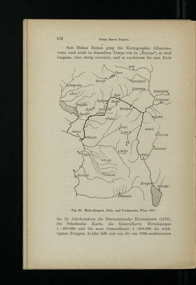
Drin- und Vardarreise
1916
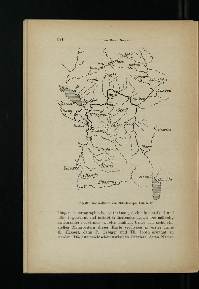
Generalkarte von Mitteleuropa
1916
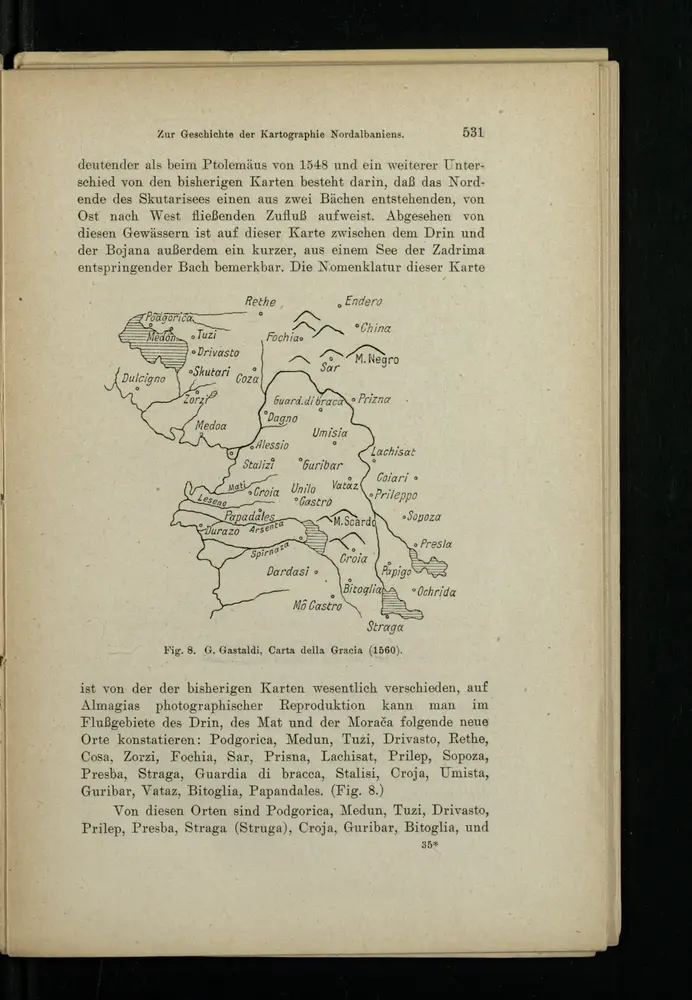
Carta della Gracia
1916
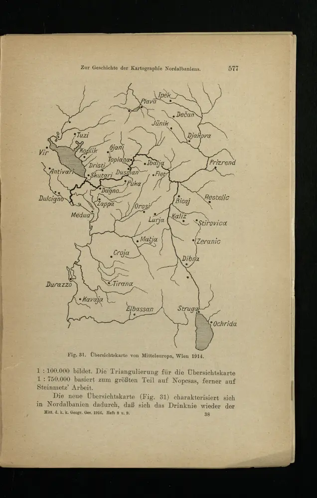
Übersichtskarte von Mitteleuropa
1916
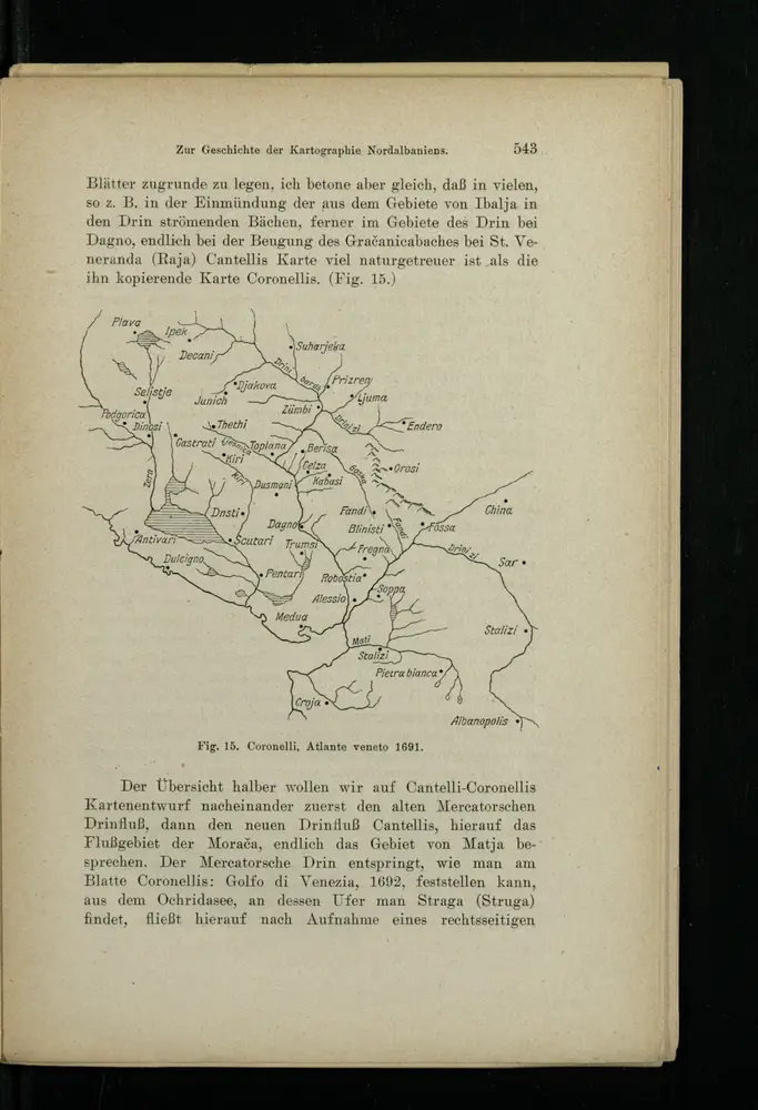
Atlante veneto
1916
[Nordalbanien]
1916
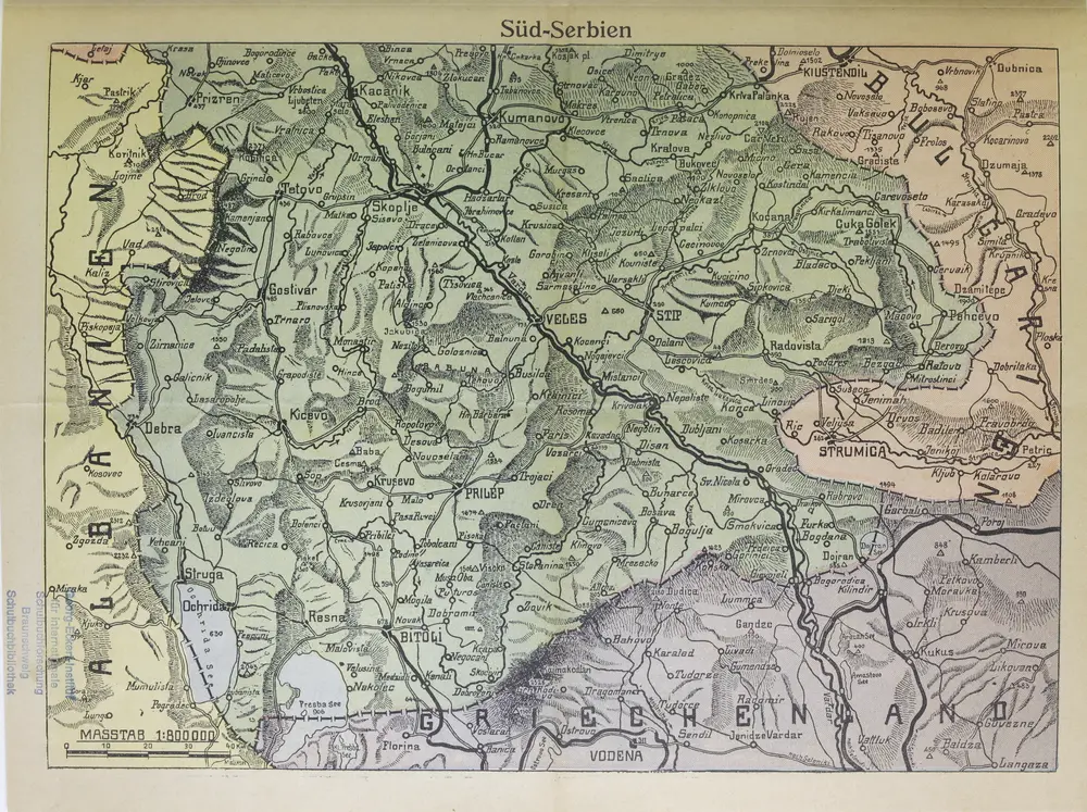
Süd-Serbien
1916
1:800k
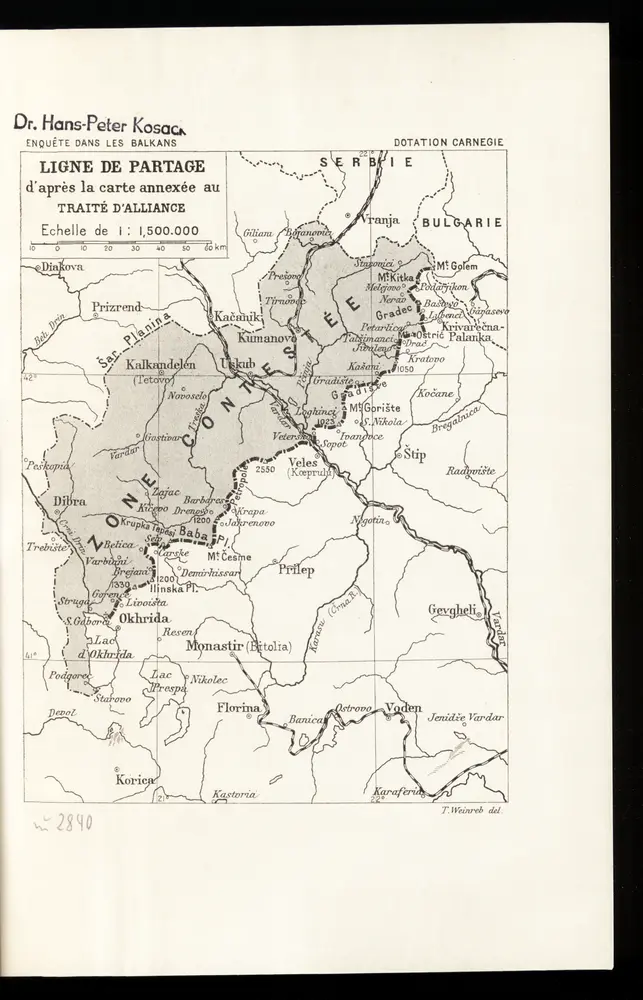
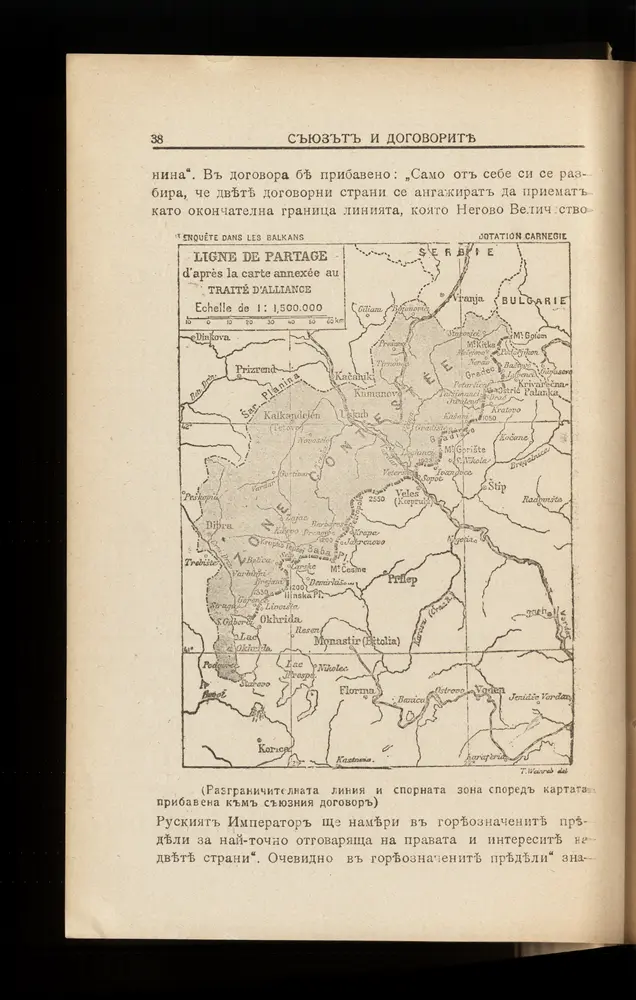
Ligne de partage d'après la carte annexée au Traité d'Alliance
1912
Th. Weinreb del.
Ligne de partage d'après la carte annexée au traité d'alliance
1913
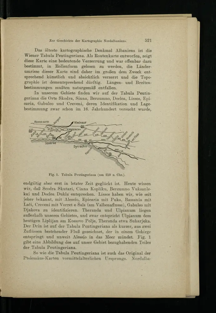
Tabula Peutringeriana
1916
History
Old maps of Centar Župa Municipality
Discover the past of Centar Župa Municipality on historical maps
Old maps of Centar Župa Municipality
Discover the past of Centar Župa Municipality on historical maps
Explore
Sign in
Parent places
Albania
Related places