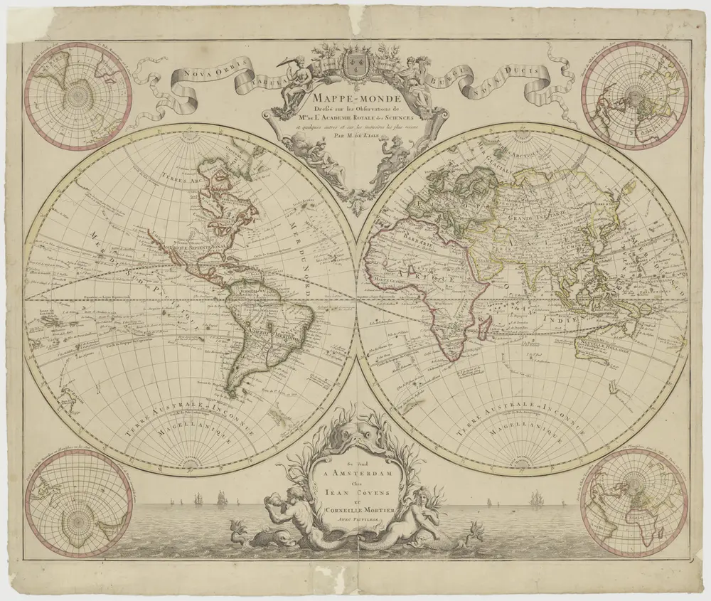
"Mappemonde dressé sur les observations de Mrs de l'Académie Royale des Sciences enz.", met dubbeltitel: "Nova orbis tabula ad usum serenissimi Burgundiae Ducis." (Twee halfronden).
1710
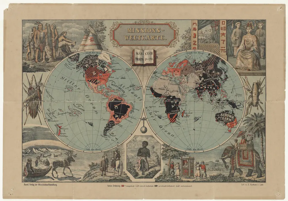
Missions-Weltkarte / lith. von E. Kaufmann
1891
E. Kaufmann
1:80m
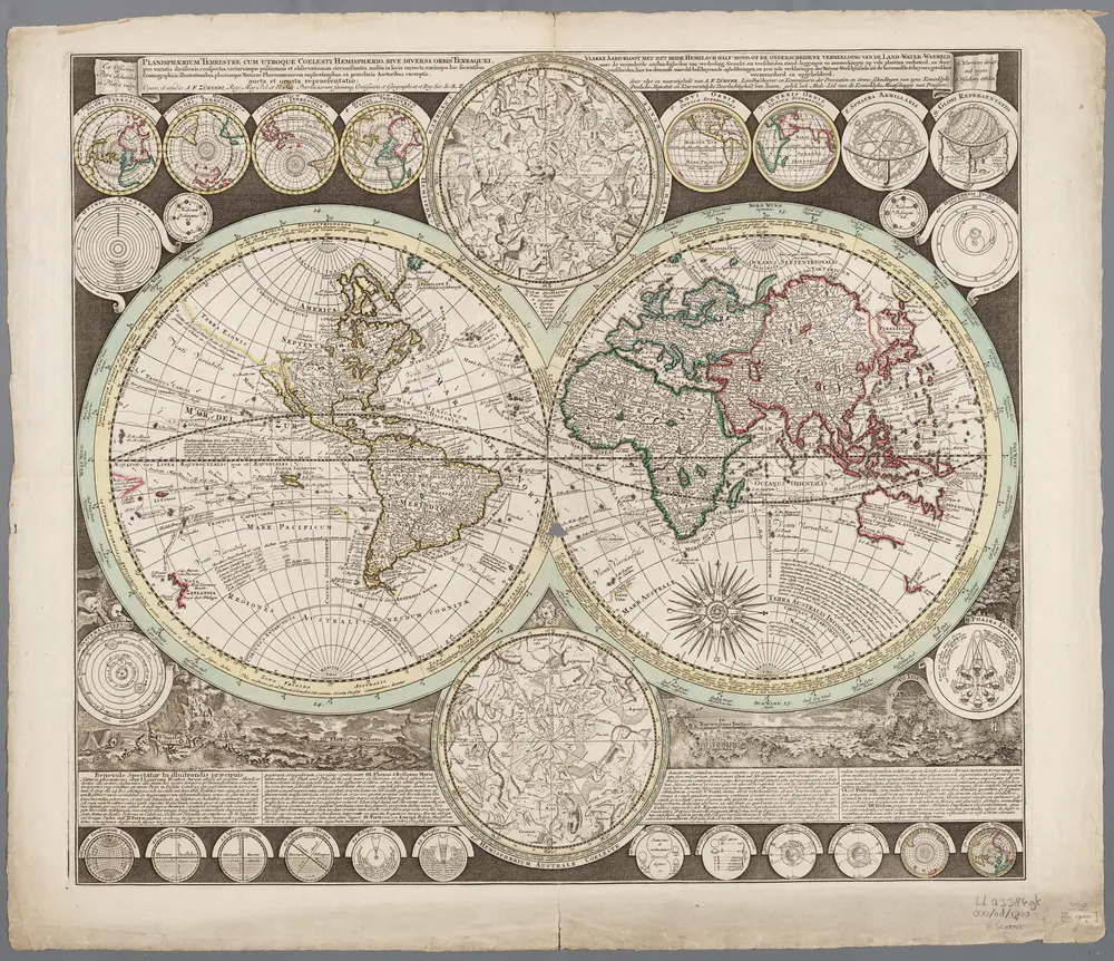
Planisphaerium terrestre cum utroque coelesti hemisphaerio, sive diversa orbis terraquei ... / opera et studio A.F. Zürneri = Vlakke Aard-kloot met het beide hemelsch half-rond, of de onderscheidene verbeelding van de land-water-waereld ... / door vlyt en naarstigheid van A.F. Zürner
1700
Adam Friedrich Zürner 1680-1742
1:74m
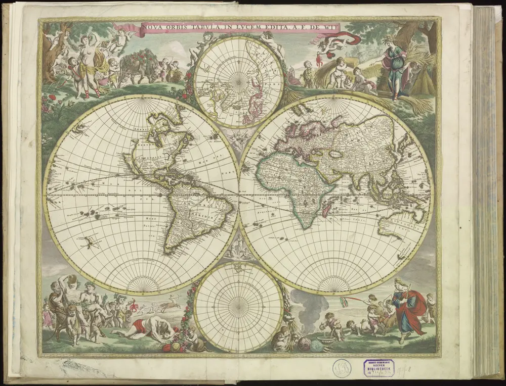
[1] Nova orbis tabula, uit: Atlas sive Descriptio terrarum orbis
1690
Wit, Frederik de
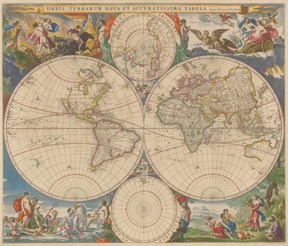
Orbis Terrarum Nova Et Accuratissima Tabula. [Karte], in: Novus atlas absolutissimus, Bd. 1, S. 17.
1647
Janssonius Offizin
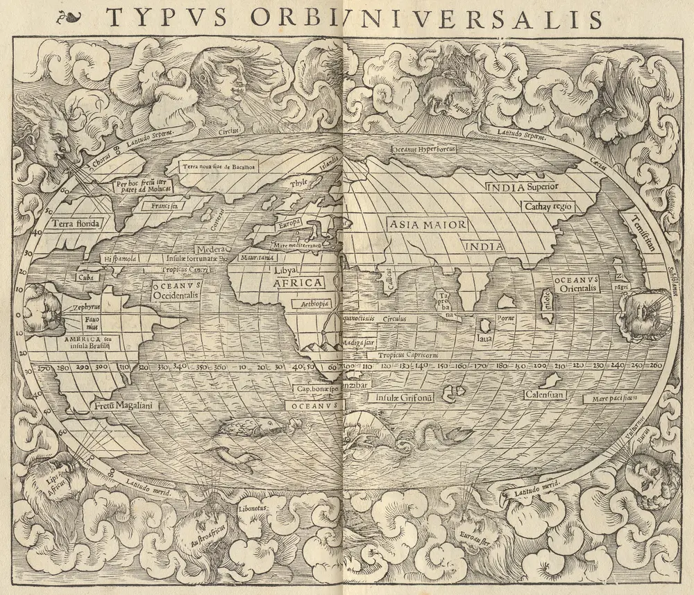
Typus Orbis Universalis [Karte], in: Claud. Ptolemaeus. Geographia lat. cum mappis [...], S. 248.
1540
Münster, Sebastian [und Ptolemaeus, Claudius]
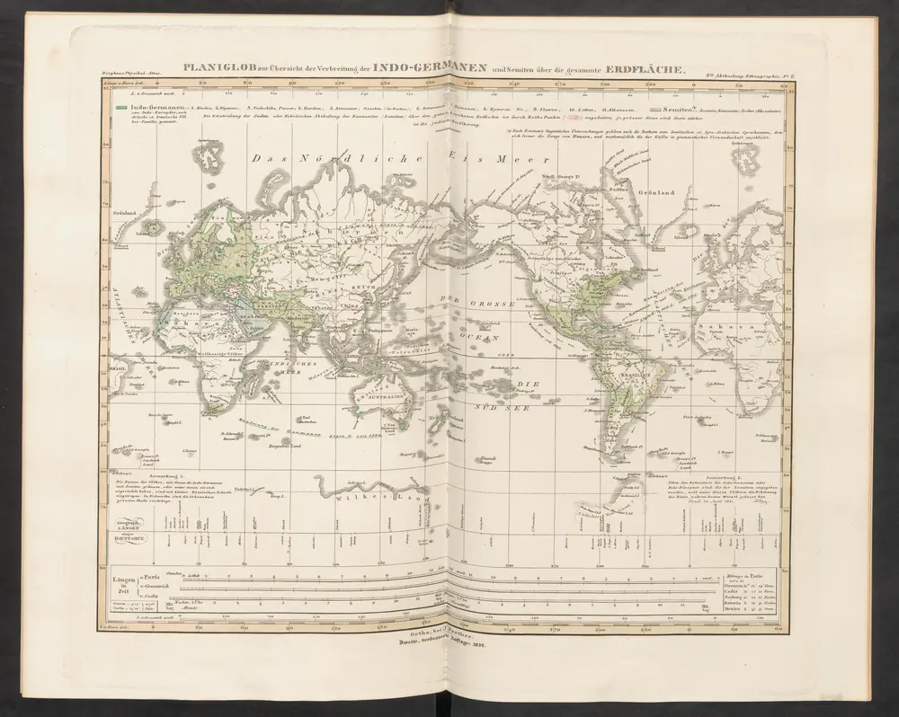
Planiglob zur Übersicht der Verbreitung der Indo-Germanen und Semiten über die gesammte Erdfläche
1852
Humboldt, Alexander von
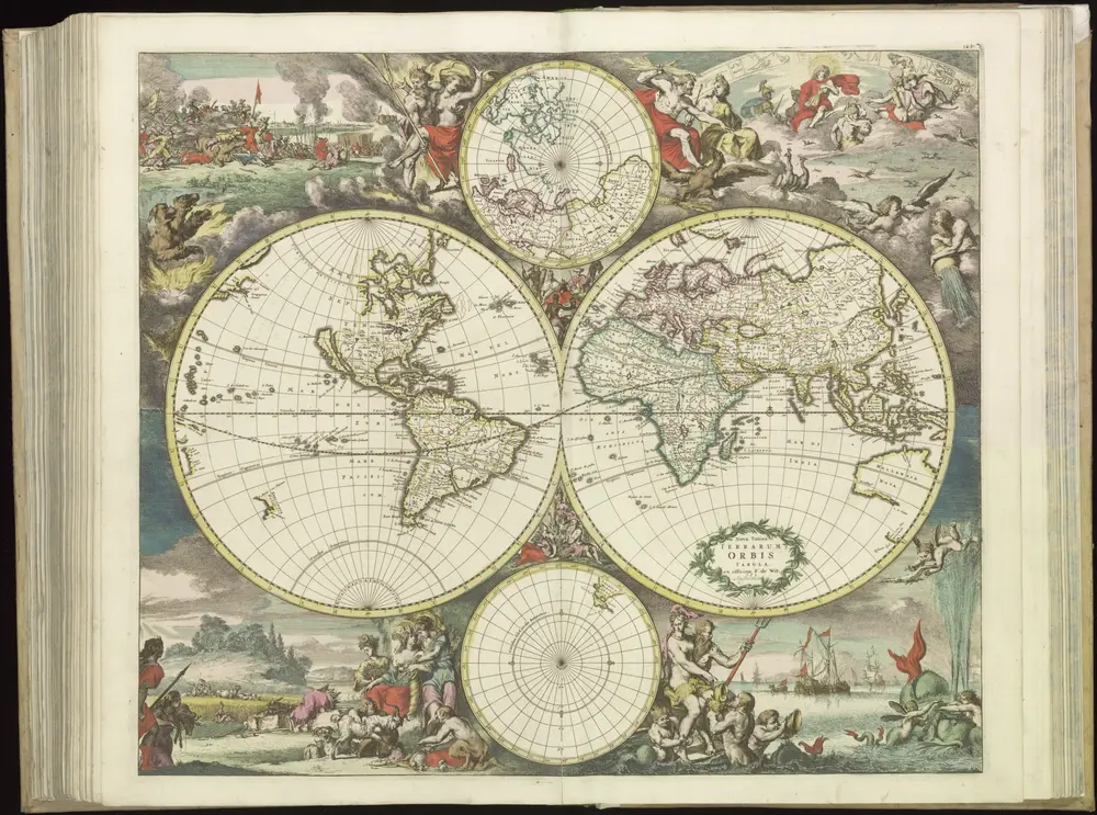
[121][124] Nova totius terrarum orbis tabula, uit: Atlas sive Descriptio terrarum orbis
1690
Wit, Frederik de
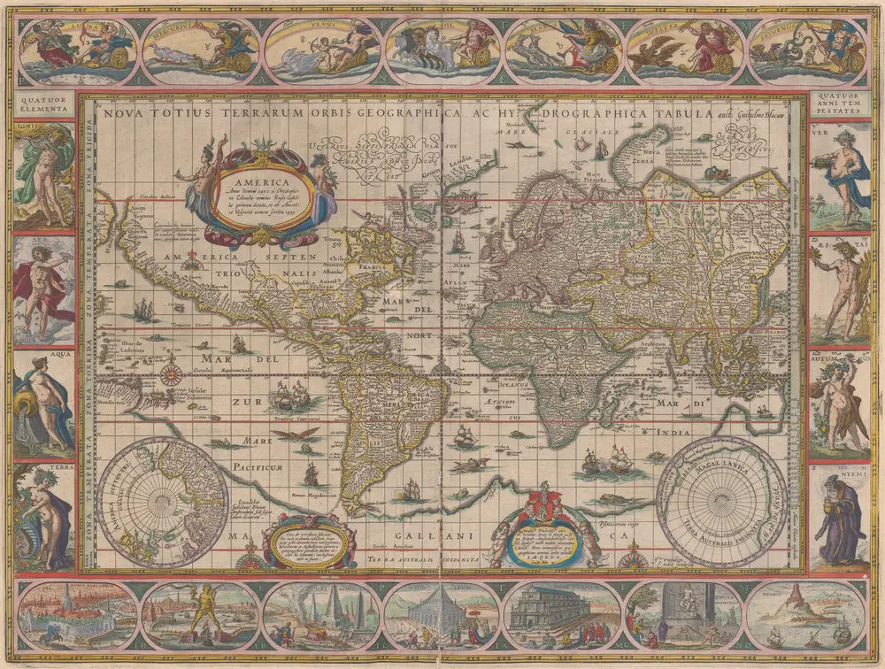
Nova Totius Terrarum Orbis Geographica Ac Hydrographica Tabula [Karte], in: Novus Atlas, das ist, Weltbeschreibung, Bd. 1, S. 16.
1641
Blaeu, Joan
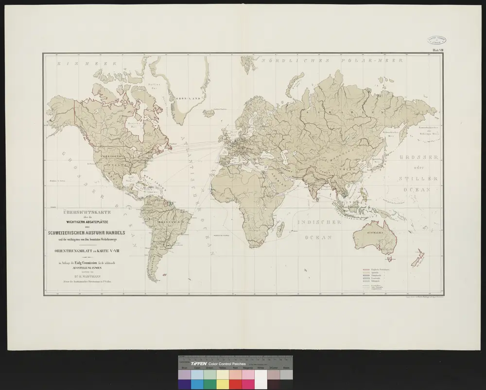
Atlas über die Entwicklung von Industrie und Handel der Schweiz in dem Zeitraume vom Jahr 1770 bis zum Jahr 1870
1873
im Auftrage der schweizerischen Commission für die additionellen Ausstellungen in Wien, bearbeitet von Dr. Hermann Wartmann
1:45m
A touch of history
Browse historical places and search for old maps with timeline.
Discover history through OldMapsOnline
Browse and view places with timeline, compare historical maps to see the evolution of a place
Looking for a Google Maps API Alternative?