Cataloged map
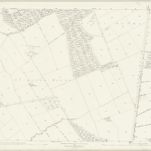
Nottinghamshire XLVII.5 (includes: Clipston On The Wolds; Cotgrave; Owthorpe; Plumtree; Stanton On The Wolds) - 25 Inch Map

Institution:National Library of Scotland
Full title:Nottinghamshire XLVII.5 (includes: Clipston On The Wolds; Cotgrave; Owthorpe; Plumtree; Stanton On The Wolds) - 25 Inch Map
Depicted:1883
Pubdate:1884
Publisher:Ordnance Survey
Map scale:1:2 500