Gecatalogiseerde kaart
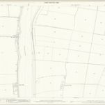
Lincolnshire X.6 (includes: Amcotts; Burton upon Stather; Flixborough; Garthorpe) - 25 Inch Map

Instelling:National Library of Scotland
Volledige titel:Lincolnshire X.6 (includes: Amcotts; Burton upon Stather; Flixborough; Garthorpe) - 25 Inch Map
Jaar illustratie:1885
Pubdatum:1886
Uitgever:Ordnance Survey
Schaal kaart:1:2 500