Gecatalogiseerde kaart
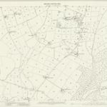
Staffordshire XVIII.4 (includes: Caverswall; Dilhorne) - 25 Inch Map

Instelling:National Library of Scotland
Volledige titel:Staffordshire XVIII.4 (includes: Caverswall; Dilhorne) - 25 Inch Map
Jaar illustratie:1897 - 1898
Pubdatum:1900
Uitgever:Ordnance Survey
Schaal kaart:1:2 500