Gecatalogiseerde kaart
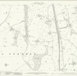
Lancashire XXXIV.7 (includes: Ashton With Stodday; Ellel; Scotforth) - 25 Inch Map

Instelling:National Library of Scotland
Volledige titel:Lancashire XXXIV.7 (includes: Ashton With Stodday; Ellel; Scotforth) - 25 Inch Map
Jaar illustratie:1910
Pubdatum:1913
Uitgever:Ordnance Survey
Schaal kaart:1:2 500