Maps of Green Bay

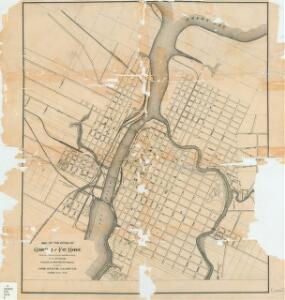
Map of the cities of Green Bay and Fort Howard : from late official surveys and map made by J.V. Suydam
This map shows streets, buildings, railroads, the Fox River, the East River, and part of Green Bay. Brauns, A. State Gazette
Green Bay West
1 : 24000
Town of Preble, Brown County, Wis.
1 : 7700 This map shows landownership and acreages, additions to Green Bay, roads, railroads, East River, and Fox River. The bottom left of the map reads: "January 1935. Population-3400." Dorath, A. A.
Map of Brown County, State of Wisconsin.
1 : 126720 Snyder, Van Vechten & Co.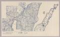
Section 3. Bicycle Road Map of Wisconsin.
1 : 253440 League of American Wheelmen, Wisconsin Division
Wisconsin S. part.
1 : 780000 Morse, Sidney E. (Sidney Edwards), 1794-1871
Triangulation in Wisconsin
1 : 506880 This map shows names of triangulation stations, railroads, counties, rivers, and lakes. The Mississippi River, Lake Winnebago, and Lake Michigan are labeled. The upper right corner includes a key of markings. The map covers north to Eau Claire. Davies, John Eugene Wisconsin Geological Survey
Educational map of the state of Wisconsin
1 : 380160 This map is ink on paper and shows the location of various types of schools. The map includes text about the school system and tables of statistics (1849-1875) including: Number of children-attendance -- Apportionment of state money -- School houses -- Annual expenses -- Teachers and certificates -- Teachers' wages -- Territorial divisions -- Statistics for 1875 -- Statistics of cities. The map also includes illustrations of: River Falls Normal School -- Oshkosh Normal School -- Platteville Normal School -- University of Wisconsin (Ladies Hall, S. Dormitory, University Hall, N. Dormitory) -- Science Hall (University of Wisconsin) -- Whitewater Normal School. Searing, Edward
A Geological Map of Wisconsin
1 : 1710720 This map shows counties, cities, rivers, canals, lakes, railroads, common roads, county towns, townships, villages, and post offices. The map includes part of the upper peninsula of Michigan. Lapham, Increase Allen
Wisconsin.
1 : 1340000 Mitchell, Samuel Augustus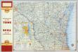
Shell Highway Map of Wisconsin (northern portion).
1 : 950400 Shell Oil Company
Iowa And Wisconsin.
1 : 1600000 Goodrich, S.G.
Iowa and Wisconsin.
1 : 1600000 Bradford, Thomas G.
Wisconsin.
1 : 1030000 Rand McNally and Company
Wisconsin.
1 : 2100000 Rand McNally and Company
Climatological map of Wisconsin.
1 : 1520640 Snyder, Van Vechten & Co.
Map of the State of Wisconsin.
1 : 1140480 Snyder, Van Vechten & Co.
State of Wisconsin.
1 : 760320 U.S. General Land Office
Geological map of Wisconsin.
1 : 1520640 Snyder, Van Vechten & Co.
Map of Wisconsin showing congressional and judicial districts.
1 : 1520640 Snyder, Van Vechten & Co.
Map of Wisconsin showing senatorial districts.
1 : 1520640 Snyder, Van Vechten & Co.
Map of Wisconsin, showing assembly districts.
1 : 1520640 Snyder, Van Vechten & Co.
Wisconsin.
1 : 1330560 Cram Atlas Company
Wisconsin.
1 : 1140480 U.S. General Land Office
Wisconsin.
1 : 1600000 Grassl, J. (Joseph)
AutoTrails Map, Wisconsin, Northern Illinois, Northern Michigan.
1 : 928000 Rand McNally and Company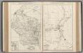
Wisconsin. Milwaukee.
Rand McNally and Company
Wisconsin
Map of Wisconsin with drawings illustrating historic places and events throughout the state. The Great Seal of the State of Wisconsin appears at the top right and the flags of Spain (1600), France (1700), England (1794), and a U.S. flag (1805) appear at left. There is a key explaining all 104 drawings at the bottom of the map. Kishner, Mel Wisconsin Tales and Trails, Inc.
Preliminary traffic map, showing annual 24 hour average traffic, state of Wisconsin
1 : 1198000 This blue line print map shows highways, the scale of traffic volume, and average 24 hour traffic. Also included are inset maps of Appleton, Neenah, and Menasha, Waukesha County, Milwaukee County, Racine County, Kenosha County, Washington County, and Ozaukee County. Wisconsin. State Highway Commission Wisconsin. State Highway Commission