Maps of Africa
Schul-Atlas für die alte Erdbeschreibung : zur allgemeinen Schul-encyclopädie gehörig
J. H. Campe Zusammensetzung und Zeichnung von [...] Dufour, unter Leitung von Heusinger ; gestochen von Frentzel. Braunschweig : Schulbuchhandlung
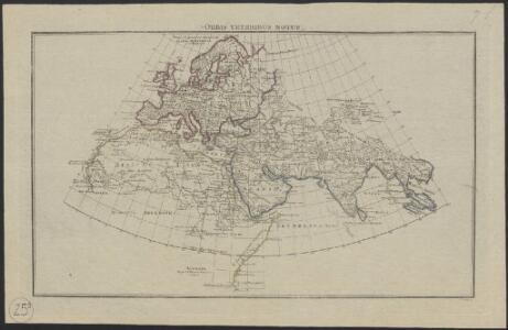
Orbis Veteribus Notus
Schul-Atlas der alten Welt bei Justus Perthes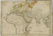
Orbis veteribus notus scilicet: Europa, Asia, Africa : publici juris factus / auctor d'Anville
1 : 16250000 Annotatie geografische gegevens: Met 8 schaalstokken Jean-Baptiste Bourguignon d' Anville 1697-1782 Norimbergae : prostat in officina Adami Theophili Schneideri-Weigeliana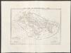
Carta generale del mondo conosciuto dagli antichi
1 : 25000000 Marzolla, Benedetto Reale Litografia Militare
Asien
1 : 33633000 gezeichnet von H. Kiepert gestochen von W. Weiler Weimar : Geographisches Institut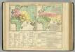
World as Known to the Ancients; Division ...among the Posterity of Noah.
1 : 54400000 Lavoisne, M.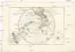
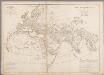
Mappe-monde sur un plan horisontal
Austrálie André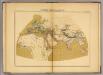
Le Monde connu des anciens au deuxieme siecle de Iere. chretienne.
1 : 32000000 Vivien de Saint-Martin, M.
Generalkarte saemmtlicher Entdeckungen auf den drei grossen Weltreissen des Kapit. Jakob Cook
Afrika Roberts, Heinrich Schraembl, Franz Anton F.A. Schraembl
Verbreitung der vorzuglicheren Saugethiere der Neuen Welt.
1 : 50000000 Berghaus, Heinrich
Resource-Relief Maps of: Europe and Australia.
Hammond, C.S.
Mountain Chains in Asia & Europe
The physical atlas Johnston, Alexander Keith William Blackwood & Sons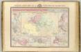
Geographie de l'antiquite.
Garnier, F. A., 1803-1863
Asia
Schul-Atlas über alle Theile der Erde nach dem neuesten Zustande, und über das Weltgebäude Stieler, Adolf bei Justus Perthes
[Historisch-geographischer Atlas zu den allgemeinen Geschichtswerken von C. v. Rotteck, Pölitz u. Becker] : Erdansichten zur Uebersicht der wichtigsten geograpischen Systeme des Alterthums
von Julius Loewenberg [Freiburg im Breisgau] : [Herder]
Index chart of hydropac messages / Under the authority of the Secretary of the Navy [by the] Hydrographic Office
Hydrographic Office Washington D.C. Washington D.C. : Hydrographic Office
[Asien, Politische Übersicht]
E. von Sydow's Schul-Atlas in sechs und dreissig Karten Sydow, Emil von bei Justus Perthes
[Bergketten in Asien und Europa]
Erster Band, enthaltend in vier Abtheilungen die Erscheinungen der anorganischen Natur: 1. Meteorologie und Klimatographie. 2. Hydrologie und Hydrographie. 3. Geologie. 4. Tellurischer Magnetismus Humboldt, Alexander von Verlag von Justus Perthes
Asien und Europa
Atlas der Geologie Zittel, K.v. ; Berghaus, Hermann Justus Perthes
Migrations des Peuples.
Andriveau-Goujon, J.
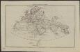
Die den Alten bekannte Welt
Historisch-genealogisch-geographischer Atlas von Le Sage Las Cases, Emmanuel Auguste Dieudonné Marius Joseph de Johann Velten, Kunsthändler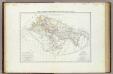
Carta generale del mondo conosciuto dagli antichi.
1 : 26000000 Marzolla, Benedetto
Grosser Ocean.
1 : 75000000 Andree, Richard
Asien
Adolf Stieler's Handatlas über alle Theile der Erde und über das Weltgebäude Stieler, Adolf Justus Perthes
Stiller Ozean
1 : 10000000 Tichý oceán Justus Perthes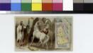
Arabia.
From [Series of advertising cards issued by Arbuckle Bros. Coffee Company, each consisting of a map of a country of the world with related illustrations.]
World as known to Ptolemy.
1 : 95000000 Fenner, Rest.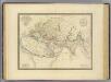
Monde ancien.
1 : 28000000 Andriveau-Goujon, J.