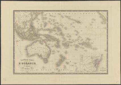
Maps of Polynesia
Nouvelle carte de l'Océanie
1 : 26450000 dressée par A. Vuillemin [...] gravée par L. Grenier ; écrite par Isid. Dumont Paris : Robiquet, Quai des Augustins, 39
Australien
Hand-Atlas über alle Theile der Erde nach dem neuesten Zustande und über das Weltgebäude Stieler, Adolf bei Justus Perthes
Australien und Polynesien
Hand-Atlas über alle Theile der Erde nach dem neuesten Zustande und über das Weltgebäude Stieler, Adolf bei Justus Perthes
Australien
Stieler's Hand-Atlas Stieler, Adolf bei Justus Perthes
[Recto], uit: Australië en Oceanië / [aardrijksk. medew. G.J. de Vries]
1 : 68000000 titelvariant: Australië (en Oceanië); Annotatie: Titel boven krt. en op verso: Australië (en Oceanië); Verso: statistische gegevens voornaamste staatkundige gebieden; Annotatie geografische gegevens: Inzet: Indonesië. - 1:54.000.000 Gerben Johannes de Vries 1886-1968 Sneek : Tonnema
Australien
Neuer Handatlas über alle Theile der Erde Kiepert, Heinrich Verlag von Dietrich Reimer
Oceanien
Geographischer Atlas über alle Theile der Erde Ziegler, Jakob Melchior Verlag von Joh. Wurster um Comp.
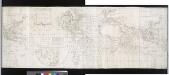
Carte réduite de la Mer des Indes, et d'une partie de celle du sud : pour la relation du voyage à la recherche de la Pérouse, du Cen. Labillardière
1 : 27750000 dressée par J. D. Barbié Du Bocage, an VIIIème de la République D'houdan sculpsit ; Dien scripsit [Paris] : [s.n.]
Australien
1 : 26000000 gezeichnet von J.M.F. Schmidt gestochen von H. Brose Berlin : bei Simon Schropp et Comp.
Die Samoa-Inseln und die gegenwärtigen Besitzverhältnisse der Kolonialstaaten im Indischen- und Grossen Ocean
1 : 25000000 Dietrich Reimer
Oceanien
Geographischer Atlas über alle Theile der Erde Ziegler, Jakob Melchior Verlag von Dietrich Reimer
Oceanien
[Allgemeiner Atlas über alle Theile der Erde in 29 Blättern] Ziegler, Jakob Melchior Top. Anstalt v. J. Wurster u. Comp.
Neueste Karte von Australien
Grosser Hand-Atlas über alle Theile der Erde in 170 Karten Meyer, J. Verlag des Bibliographischen Instituts
Australien und Oceanien
Volksschul-Atlas über alle Teile der Erde Lange, Henry Druck und Verlag von Georg Westermann
Australien
Schul-Atlas in 36 Karten Völter, Daniel Verlag der J.M. Dannheimer'schen Buchhandlung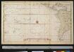
De Zuijdt Zee
Pacific Ocean Gerard van Keulen
Mar Del Zur Hispanis Mare Pacificum. [Karte], in: Het vijfde Deel Des Grooten Atlas : Vervatende De Water-Weereld, S. 101.
1 Karte aus Atlas Jansson, Jan Jansson, Jan
[Polynesien und der Grosse Ocean, Westliches Blatt]
Hand-Atlas über alle Theile der Erde und über das Weltgebäude Stieler, Adolf Justus Perthes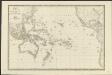
Carte de l'Océanie ou cinquième partie du monde
1 : 26450000 par A. H. Brué, Geographe de S.A.R. Monsieur A Paris [etc.] : [chez J. Goujon, Rue du Bac, No. 6, près le Pont Royal, [etc.]
Carte particulière de La Polynésie : parties orientale et septentrionale de L'Océanie [...]
1 : 23150000 réd. par A. H. Brué [...] d'aprés l'ensemble des matériaux recueillis jusqu'à ce jour, 1826 [...] Paris : chez Chles. Picquet
[Polynesien und der Grosse Ocean (westliches Blatt)]
Adolf Stieler's Handatlas über alle Theile der Erde und über das Weltgebäude Stieler, Adolf Justus Perthes
[Polynesien und der Grosse Ocean, westliches Blatt]
Handatlas über alle Theile der Erde und über das Weltgebäude Stieler, Adolf Justus Perthes
Australien
Neuester Schul-Atlas Walch, Johann im Verlag bei Joh. Walch
Mar Del Zur Hispanis Mare Pacificum. [Karte], in: Novus atlas absolutissimus, Bd. 9, S. 136.
1 Karte aus Atlas Janssonius Offizin
Karte von dem Vulkan Gürtel und den Central Gruppen des Grossen Oceans
Erster Band, enthaltend in vier Abtheilungen die Erscheinungen der anorganischen Natur: 1. Meteorologie und Klimatographie. 2. Hydrologie und Hydrographie. 3. Geologie. 4. Tellurischer Magnetismus Humboldt, Alexander von Verlag von Justus Perthes
Australien
Atlas der Pflanzengeographie über alle Theile der Erde Rudolphi, Ludwig Verlag der Nicolaischen Buchhandlung
Mar del Zur Hispanis Mare Pacificum. [Karte], in: De Nieuwe Groote Vermeerderde Zee-Atlas ofte Water-Werelt, S. 71.
1 Karte aus Atlas Doncker, Hendrick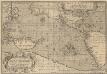
Maris Pacifici, (quod vulgò Mar del Zur) cum regionibus circumiacentibus [...] [Karte], in: Theatrum orbis terrarum, S. 64.
1 Karte aus Atlas Ortelius, Abraham Vrients, Jan Baptista
Australien
Allgemeiner Atlas [Walch, Johannes] im Verlag bei Johannes Walch