Maps of Polynesia
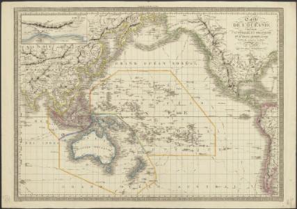
Carte de l'Océanie comprenant l'Australie, la Polynésie et du Grand Archipel d'Asie
1 : 37000000 dressée par Hérisson, géographe gravé par J. B. Tardieu ; Pelicier scrip. Paris : chez Jean, Rue St. Jean-de-Beauvais, No. 10
Carte des communications télégraphiques
1 : 70000000 Mager, Henri 1859-19..; L'Expansion française coloniale Paris : L'Expansion coloniale française
Westlicher Planiglob der Erde
1 : 17000000 Weimar : Verlag des Geographischen Instituts
Wereldkaart volgens Mercator's projectie
Bruxelles : Institut National de Géographie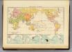
Religions.
1 : 114000000 Andree, Richard; Times (London, England)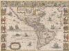
Americae nova Tabula. [Karte], in: Theatrum orbis terrarum, sive, Atlas novus, Bd. 2, S. 307.
1 Karte aus Atlas Blaeu, Joan Blaeu, Willem Janszoon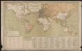
Carte générale des lignes télégraphiques internationales
1 : 40000000 Jaccottey, Paul Paris : Ch. Delagrave
[Zoological Geography, Geographical Division and Distribution of Reptilia (Reptiles)]
The physical atlas Johnston, Alexander Keith William Blackwood & Sons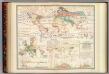
Distribution: plants.
1 : 67000000 Johnston, Alexander Keith, 1804-1871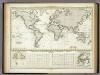
Versuch Einer Karte Zur ?bersicht Der Fluthwellen.
1 : 95000000 Berghaus, Heinrich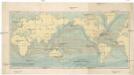
Uebersicht der Strömungen des Meeres
země světa Christmann, Fr. Hartwig Meidinger Sohn
Verbreitung des Katzen-Geschlechts, Genus-Felis, so wie der Hyane.
1 : 115000000 Berghaus, Heinrich
Vulkane, Koralleninseln.
1 : 110000000 Andree, Richard
Streams, currents and drifts in the Pacific Ocean : mainly from the British Admirality chart No. 2640
1 : 33000000 United States. Hydrographic Office Hydrographic Office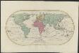
Mappemonde ou Carte générale de l' univers sur une projection nouvelle d'une sphére ovale pour mieux entendre les distances entre l'Europe et Amerique : avec le tour du monde du lieut. Cook et tous les découvertes nouvelles
1 : 45000000 dessinée et gravée par Mathieu Albert Lotter A Augsbourg : [s.n.]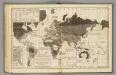
Moral, political World.
1 : 133000000 Woodbridge, William C.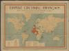
Empire colonial français
1 : 28000000 Barrère, Henry; Ligue coloniale française Paris : Maison Andriveau-Goujon H. Barrère
Americae nova Tabula. [Karte], in: Le théâtre du monde, ou, Nouvel atlas contenant les chartes et descriptions de tous les païs de la terre, Bd. 2, S. 298.
1 Karte aus Atlas Blaeu, Willem Janszoon und Blaeu, Joan Blaeu, Willem Janszoon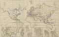
XIII. Charte für die allgemeine Geschichte von Friedrich IIten Tode bis auf den Frieden von Presburg : d.i. von 1786 bis 1805 n. Christus
Entworfen von F.W. Benicken grav. von A. Falger Weimar : im Verlage des L. Industrie-Comptoirs
[Zoological Geography, Geographical Division & Distribution of Carnivora]
The physical atlas Johnston, Alexander Keith William Blackwood & Sons
Weltkarte zur Uebersicht der vorzügluchsten Varietaeten des Menschen, nach Blumenbach'schen Systeme
1 : 82300000 entworfen und gezeichnet von C.F. Weiland nach Bory de St. Vincent entworfen und gezeichnet von C.F. Weiland Weimar : Im Verlage des Geograph. Instituts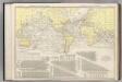
Steamship Routes of The World.
1 : 60000000 Rand McNally and Company
Fluthwechsel, Tidenströme, Gang der Hafenzeiten
Atlas der Hydrographie Berghaus, Hermann Justus Perthes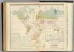
Health, disease.
1 : 67000000 Johnston, Alexander Keith, 1804-1871
British Empire, routes, currents.
1 : 90000000 Andree, Richard; Times (London, England)
Seetiefen, Küsten, Häfen, Dichte des Seewassers
Atlas der Hydrographie Berghaus, Hermann Justus Perthes
Übersicht der Erde
Atlas der Geologie Zittel, K.v. ; Berghaus, Hermann Justus Perthes
Linien gleicher Deklination (Isogonen)
Atlas des Erdmagnetismus Neumayer, Georg Justus Perthes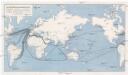
Die Weltmeere als Kriegsschauplatz
1 : 75000000 země světa Volk und Reich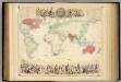
British Empire Throughout the World Exhibited In One View.
1 : 30000000 Fullarton, A. & Co.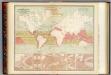
Currents of air.
1 : 70000000 Johnston, Alexander Keith, 1804-1871
Seven Puzzle Maps of the World.
Logerot
Vertheilung der Nagethiere und Wiederkauer.
1 : 130000000 Berghaus, Heinrich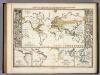
Verbreitungsbezirke Der Wichtigsten Kulturgewachse.
1 : 130000000 Berghaus, Heinrich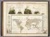
Umrisse Der Pflanzengeographie.
1 : 130000000 Berghaus, Heinrich