Maps of Malay Archipelago
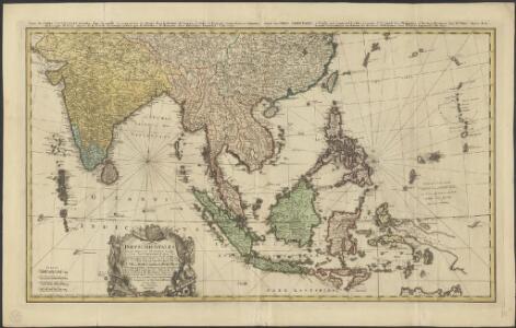
Carte des Indes Orientales
1 : 10000000 dessinée suivant les observations les plus recentes, dont le principal est tirée des cartes hydrographiques de Mr. D'Apres de Mannevillette dediée tres humblement à [...] Guillaume Charles Henry Friso [...] par [...] l'auteur et les Heritiers de Homan(n) ; S. Dorn fe. [Nürnberg] : Heritiers de Homann
East Indies from the best authorites
1 : 26000000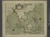
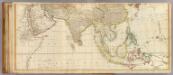
A chart of the eastermost part of the EAST INDIES and CHINA, from cape comarine to IAPAN, with all adjacent Islands
from The sea-atlas : containing an hydrographical description of most of the sea-coasts of the known parts of the world.

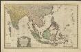
INDIA | quæ | ORIENTALIS | dicitur | ET | INSVLÆ | ADIACENTES.
[Amsterdam : Joan Blaeu]
India quae Orientalis dicitur, et Insulae Adiacentes. [Karte], in: Novus atlas absolutissimus, Bd. 6, S. 144.
1 Karte aus Atlas Janssonius Offizin
Ost-Indien.
1 : 18500000 Stulpnagel, F.v.

Kaart van de afdeeling, eiland Saleijer (Silaijara), uit: Kaart van Zuid Celebes met uitzondering van het Rijk Gowa
1 : 200000 Annotatie: Met administratieve indeling 's-Gravenhage : Topographische Inrichting
India quae Orientalis dicitur, Et Insulae Adiacentes. [Karte], in: Theatrum orbis terrarum, sive, Atlas novus, Bd. 2, S. 248.
1 Karte aus Atlas Blaeu, Joan Blaeu, Willem Janszoon
India quae Orientalis dicitur, et Insulae Adiacentes. [Karte], in: Novus Atlas, das ist, Weltbeschreibung, Bd. 2, S. 263.
1 Karte aus Atlas Blaeu, Joan Blaeu, Willem Janszoon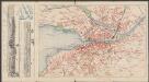
India quae Orientalis dicitur, Et Insulae Adiacentes. [Karte], in: Le théâtre du monde, ou, Nouvel atlas contenant les chartes et descriptions de tous les païs de la terre, Bd. 2, S. 239.
1 Karte aus Atlas Blaeu, Willem Janszoon und Blaeu, Joan Blaeu, Willem Janszoon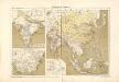
Atlas für Industrie- und Handelsgeographie: Für commercielle und technische Lehranstalten, für Kaufleute und Industrielle

CARTE DES INDES ORIENTALES
1 : 10700000 Asie jihovýchodní Mayer, Tobias Apres de Mannevillette, Jean-Baptiste-Nicolas-Denis d' Heritiers de Homan[n]
Ostindien und China
1 : 25000000 Himálaj Kocen, Blaž Eduard Hölzel
Ost-Indien
Hand-Atlas über alle Theile der Erde und über das Weltgebäude Stieler, Adolf Justus Perthes
India
1 : 19000000 Asie jihovýchodní Spruner, Karl von Justus Perthes
Indien und Ostasien
1 : 10000000 Asie východní Verlagsanstalt List & von Bressensdorf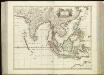
[75][75] Tabula Indiae Orientalis, uit: Atlas sive Descriptio terrarum orbis
Annotatie: Gedigitaliseerde versie. Amsterdam. Heiloo : Picturae (vervaardiger), 2015. tiff-bestand. Gedigitaliseerd: 07-01-2015; Origineel: Universiteitsbibliotheek Vrije Universiteit (XL.05127.-) ; Netherlands; Titelpagina ontbreekt Wit, Frederik de Amsterdam : Frederick de Wit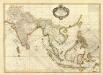
Composite: Indes.
1 : 10000000 Bonne, Rigobert, 1727-1794
Asia (middle)
1 : 11000000 Anville, Jean Baptiste Bourguignon d, 1697-1782; Kitchin, Thomas; Robert Laurie & James Whittle
Ostindien und China
E. von Sydow's Schul-Atlas in sechs und dreissig Karten Sydow, Emil von bei Justus Perthes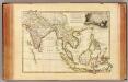
Indes Orientales.
1 : 16250000 Bonne, Rigobert, 1727-1794
Ostindien.
1 : 22000000 Reichard, C. G.
Ost-Indien
Handatlas über alle Theile der Erde und über das Weltgebäude Stieler, Adolf Justus Perthes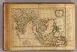
Les Indes Orientales.
1 : 29000000 Lattre, Jean
Ost-Indien mit den Inseln
Hand-Atlas über alle Theile der Erde nach dem neuesten Zustande und über das Weltgebäude Stieler, Adolf bei Justus Perthes
Ostindien mit den Inseln
Schul-Atlas über alle Theile der Erde nach dem neuesten Zustande, und über das Weltgebäude Stieler, Adolf bei Justus Perthes