Maps of Assam
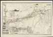
Karte von Assam und seinen Nachbar-Ländern
1 : 1000000 gest. von W. Brose u. W. Jaeck Gotha : Perthes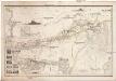
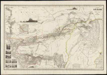
KARTE von ASSAM
1 : 1000000 Bhútán Berghaus, Heinrich Karl Wilhelm Brose, W. Justus Perthes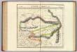
Assam et Boutan. Asie 84.
1 : 1641836 Vandermaelen, Philippe, 1795-1869
Karte von Asam, Ost-Bengalen und Nord-Birma
1 : 2275000 Bengálsko Mahlmann, Heinrich Etzel, Franz August von D. Reimer
India and adjacent countries
1 : 1000000 Bangladéš Survey of India offices
Yamdrog Tsho
1 : 2500000 United States. Army Map Service. Army Map Service
Li-ma
1 : 2500000 United States. Army Map Service. Army Map Service
Trigu Tsho
1 : 2500000 United States. Army Map Service. Army Map Service
Bhutan, No 78 I, Tongsa
India And Adjacent Countries 1:253,440 or 1" = 4 miles maps Survey of India London : War Office
Assam, No G-46 P. Haflang
Survey of India 1⁄4 inch Standard Sheets (1:253,440) Survey of India
Assam, Bhutan & Tibet, No 78M. Towang
Maps from other India Office departments Survey of India
Assam, No 83 B/NE
India And Adjacent Countries 1:126,720 or 1" = 2 miles maps Survey of India
Assam & Bengal, No 78 G/SE
India Office reference collection of maps Survey of India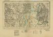
Bengal & Assam, No 78 G/11&15
India Office reference collection of maps Survey of India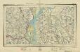
Bengal Survey, Sheet No 344
India Office reference collection of maps Survey of India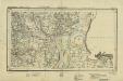
Bengal Survey, Sheet No 343
India Office reference collection of maps Survey of India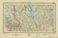
Bengal Survey, Sheet No 346
India Office reference collection of maps Survey of India
Bengal, No 78 H/9
India Office reference collection of maps Survey of India
Bengal, No 78 G/16
India Office reference collection of maps Survey of India
Bengal, No 78 H/10
India Office reference collection of maps Survey of India
Bengal, No 78 H/14
India Office reference collection of maps Survey of India
Bengal, No 78 H/13
India Office reference collection of maps Survey of India
Bengal, No 78 G/12
India Office reference collection of maps Survey of India
T'eng-ch'ung
1 : 2500000 United States. Army Map Service. Army Map Service
Fu-kung
1 : 2500000 United States. Army Map Service. Army Map Service
Kung-shan
1 : 2500000 United States. Army Map Service. Army Map Service
Bhutan & Tibet, No 78 E, Punakha
India And Adjacent Countries 1:253,440 or 1" = 4 miles maps Survey of India
Survey of that part of the boundary between the British and Jamoo Territories from the Ravi to the Jhilam
Sheet within the quarter-inch (1:253,440) series of India and Adjacent Countries. This sheet was held by the India Office Records and is currently held in that archive in the British Library. Survey of India
The Province of Bengal and Assam
India Office reference collection of maps Survey of India