Maps of China

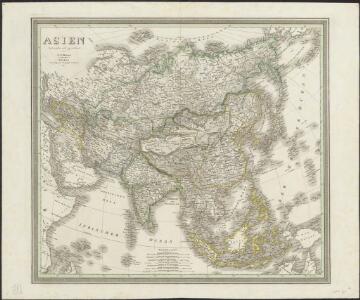
Asien
1 : 21600000 entworfen und gezeichnet von C.F. Weiland Weimar : im Verlage des Geograph. Instituts
[Kaart], uit: Asien : politisch-wirtschaftlich
1 : 12000000 Bern : Kümmerly & Frey
[Historisch-geographischer Atlas zu den allgemeinen Geschichtswerken von C. v. Rotteck, Pölitz u. Becker] : Asien zur Uebersicht des neuesten Zustandes und der wichtigsten geographische Entdeckungen
von Julius Loewenberg [Freiburg im Breisgau] : [Herder]
[Neuer Atlas der ganzen Erde nach den neuesten Bestimmungen ... : III.] Asien
Entworfen und gezeichnet von F.W. Streit H. Leutemann sc. Leipzig : J.C. Hinrichs'sche Buchhandlung
Asien nach den neuesten Untersuchungen und Reiseberichten
Historisch-genealogisch-geographischer Atlas von Le Sage Las Cases, Emmanuel Auguste Dieudonné Marius Joseph de Johann Velten, Kunsthändler
Asien zur Übersicht der natürlichen Bodenbeschaffenheit
Schul-Atlas über alle Theile der Erde nach dem neuesten Zustande, und über das Weltgebäude Stieler, Adolf Justus Perthes
Carte d'Asie : dressé sur les memoires envoyéz par le czar a l'Academie Royale des Science : sur ce que les Arabes nous ont laissé de plus exact des pays orientaux : sur un grand nombre de routiers de terre et de mer et des cartes manuscrites detaillées : le tout assujetti aux observations de l'Academie et a celles de R.R.P.P. Jesuites et autres mathematiciens
1 : 20000000 par G. De l'Isle nouvellement corrigée apres les dernieres decouvertes faite par l'Academie de Petersbourg A Amsterdam : par Covens et Mortier
Asia.
1 : 50000000 Lucas, Fielding Jr.
Accuratissima totius Asiae tabula in omnes partes divisa
1 : 25330000 de novo correcta, ac in lucem edita per Fredericum de Witt Amstelodami : ex officina J. Cóvens et C. Mortier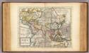
Asia.
1 : 70000000 Moll, Herman, d. 1732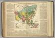
Asia.
1 : 41000000 Lavoisne, M.
Asiae Nova Delineatio [Karte], in: Novus atlas absolutissimus, Bd. 6, S. 88.
1 Karte aus Atlas Janssonius Offizin
Asien
Atlas der Pflanzengeographie über alle Theile der Erde Rudolphi, Ludwig Verlag der Nicolaischen Buchhandlung

Asiae Nova Descriptio. [Karte], in: Theatrum orbis terrarum, S. 55.
1 Karte aus Atlas Ortelius, Abraham Vrients, Jan Baptista
Asia
Handatlas über alle Theile der Erde und über das Weltgebäude Stieler, Adolf Justus Perthes
Asia recens summa cura delineata [Karte], in: Novus atlas absolutissimus, Bd. 6, S. 85.
1 Karte aus Atlas Janssonius Offizin
India Extrema; XIX. Nova Tabula. [Karte], in: Geographia universalis vetus et nova complectens Claudii Ptolemaei Alexandrini enarrationis libros VIII, S. 353.
1 Karte aus Atlas Münster, Sebastian [und Ptolemaeus, Claudius]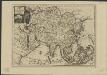
L'Asie, suivant les nouvelles observations de Messrs. de l'Académie Royale des Sciences etc., augmentées de nouveau
1 : 37000000 A Leide : chez Pierre vander Aa
Asiae noviter delineata [Karte], in: Le théâtre du monde, ou, Nouvel atlas contenant les chartes et descriptions de tous les païs de la terre, Bd. 2, S. 236.
1 Karte aus Atlas Blaeu, Willem Janszoon und Blaeu, Joan Blaeu, Willem Janszoon
[Asie]
Asie Probst, Johann Balthasar Johan[n] Michael Probst
Generalis totius Imperii Moscovitici : novissima tabula magnam orbis terrarum partem a Polo Arctico usq[ue] ad mare Iaponicum, et Chine septentrionalis confinia exhibens cum via Czaricae nuper legationis ex urbe Moscua per universam Tartariam ad magnu[m] Chinae Imperatorem
1 : 13000000 Homann, Johann Baptist, 1663-1724 [I.B. Homann]
Asie spheroidale.
1 : 41000000 Garnier, F. A., 1803-1863
[Asien, Politische Übersicht]
E. von Sydow's Schul-Atlas in sechs und dreissig Karten Sydow, Emil von bei Justus Perthes
Neueste Karte von Asien
Grosser Hand-Atlas über alle Theile der Erde in 170 Karten Meyer, J. Verlag des Bibliographischen Instituts
Asiae nova delineatio
Asie
Asiae nova delineatio
Asie Visscher, Nicolaes Jansz. Spiegel, Hendrik N. Visscher
Asiae nova delineatio
Asie Visscher, Nicolaus Spiegel, Hendrik N. Visscher
Asien
[Allgemeiner Atlas über alle Theile der Erde in 29 Blättern] Ziegler, Jakob Melchior Top. Anstalt v. J. Wurster u. Comp.