Maps of Malay Archipelago

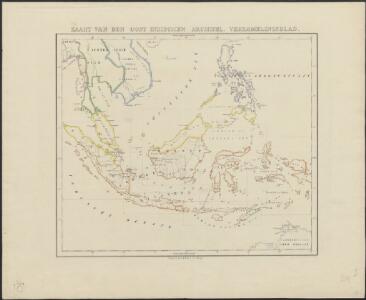
Kaart van den Oost Indischen Archipel. Verzamelingsblad
Grav. en druk v. T. Hooiberg te Leiden te 's Hage : uitgave van K. Fuhri
East India Isles.
1 : 7200000 Pinkerton, John, 1758-1826
Ostindischen Inseln.
1 : 14700000 Radefeld, Carl Christian Franz, 1788-1874
Die Ostindischen Inseln.
1 : 11500000 Stulpnagel, F.v.
Ostindischen Inseln.
1 : 11000000 Berghaus, Heinrich; Flemming, Carl; Sohr, Karl
Die Ostindischen Inseln
Hand-Atlas über alle Theile der Erde nach dem neuesten Zustande und über das Weltgebäude Stieler, Adolf bei Justus Perthes
East India Islands.
1 : 10000000 Hall, S. (Sidney)
Neueste Karte der Ostindischen Inseln
Grosser Hand-Atlas über alle Theile der Erde in 170 Karten Meyer, J. Verlag des Bibliographischen Instituts
Die Ostindischen Inseln
Hand-Atlas über alle Theile der Erde und über das Weltgebäude Stieler, Adolf Justus Perthes
Die Ostindischen Inseln
Stieler's Hand-Atlas Stieler, Adolf bei Justus Perthes
Indian Archipelago.
1 : 9187200 Fullarton, A. & Co.
Malaisie.
1 : 18500000 Malte-Brun, Conrad, 1775-1826
Die Ostindischen Inseln
Handatlas über alle Theile der Erde und über das Weltgebäude Stieler, Adolf Justus Perthes
Indes Orientales.
1 : 8400000 Robert de Vaugondy, Gilles, 1688-1766
Grand Archipel d'Asie.
1 : 10200000 Brue, Adrien Hubert, 1786-1832
Malay Archipelago.
1 : 11000000 Society for the Diffusion of Useful Knowledge (Great Britain)
South-East Asia. Pergamon World Atlas.
1 : 10000000 Polish Army Topography Service
Atlas für Handel und Industrie: Für Kaufleute, Fabrikante u. Gewerbetreibende, Handlungs- u. Gewerbe-Schulen

Malay Archipelago.
1 : 10000000 John Bartholomew and Son
East India Islands.
1 : 34000000 Fenner, Rest.
East India Islands.
1 : 16500000 Darton, William
Algemeene kaart van Nederlands Oostindie : op de schaal van 1:5.000.000 ontworpen naar de beste kaarten en bronnen / geteekend door W. Beyerinck, J.M. Bruyn en J.F.W.A. Essers, Kadetten bestemd voor de dienst in de Oostindiën ; gelithographeerd by de Koninklijke Militaire Akademie door F.J. Ensink
[Den Haag : Ministerie van Koloniën]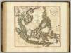
East India Isles.
1 : 8700000 Cary, John, ca. 1754-1835
East Indies.
1 : 11000000 Colton, G.W.
Islands: China-New Holland.
1 : 23000000 Bowen, Frances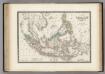
Malaisie.
1 : 1200000 Levasseur, E.
A new map of the East India Isles from the latest authorities
1 : 9000000 Cary, John, ca. 1754-1835 J. Cary
Die Ostindischen Inseln
Hand-Atlas über alle Theile der Erde nach dem neuesten Zustande und über das Weltgebäude Stieler, Adolf bei Justus Perthes