Maps of Northern Mariana Islands

Commonwealth of the Northern Mariana Islands Sheet 1 of 3
1 : 25000
Partie, Iles Mariannes. Oceanique no. 2.
1 : 1641836 Vandermaelen, Philippe, 1795-1869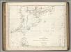
Chart of Discoveries, Made in 1787, in the Seas of China and Tartary, Sheet I.
1 : 7500000 La Perouse, Jean-Francois de Galaup, comte de, 1741-1788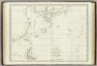
Mers, Chine, Tartarie. 1.
1 : 6250000 La Perouse, Jean-Francois de Galaup, comte de, 1741-1788
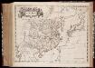
The empire of China and island of Iapan
1 : 18600000 Japonsko Moll, Herman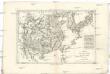
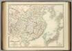
Empire de la Chine, r. de Corée et isles du Japon
1 : 12640000 Japonsko Bonne, Rigobert André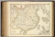
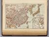
China.
1 : 6019200 Fullarton, A. & Co.
Die Länder im das Gelbe und Japanische MeerDas östliche Schan-Tung
China and Japan.
1 : 6198300 Johnston, Alexander Keith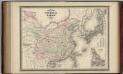
China and Japan.
1 : 9000000 Johnson, A.J.
Marianen, Carolinen en Marshall eilanden
1 : 20000000 Annotatie: Vrijgegeven door W.B.N. 29-3 '44 Den Haag : Kompas
Karten - Skizzen für die Schul - Praxis

Asia (Eastern Sheet).
1 : 14606000 Fisher, Richard Swainson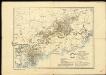
General overview of the area worked by the Basel Mission in Canton province, China
Imperii Sinarvm nova descriptio
1 : 8000000 Annotatie: Cum privilegio Sacrae Caesareae Majestatis & Ordinum Belgicae Foederatae; Origineel is Blad 196 in atlas factice [Amsterdam : J. Blaeu]
Imperii Sinarum nova descriptio
1 : 8000000 Amstelodami : ex officina J. Cóvens et C. Mortier

China and Japan.
1 : 9000000 Johnson, A.J.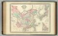
China and Japan.
1 : 9000000 Johnson, A.J.
Imperii Sinarum Nova Descriptio. [Karte], in: Novus atlas Sinensis, S. 16.
1 Karte aus Atlas Martini, Martino Blaeu, Joan
Imperii Sinarum Nova Descriptio [Karte], in: Novus atlas absolutissimus, Bd. 11, S. 14.
1 Karte aus Atlas Janssonius Offizin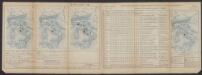
Insulae Indiae Orientalis Praecipuae, In quibus Moluccae celeberrimae sunt. [Karte], in: Gerardi Mercatoris Atlas, sive, Cosmographicae meditationes de fabrica mundi et fabricati figura, S. 538.
1 Karte aus Atlas Mercator, Gerhard Montanus, Petrus
Schauplatz der Ereignisse in Ost - Asien
China, Japan.
1 : 15000000 Andree, Richard; Times (London, England)
China and Japan.
1 : 15000000 Andree, Richard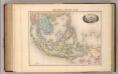
Indo-Chine et Archipel D'Asie.
1 : 14400000 Migeon, J.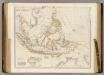
Asiatic Archipelago.
1 : 9500000 Arrowsmith, John
Hinterindien, Malayische Archipel.
1 : 18000000 Andree, Richard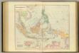
Asiatic Archipelago.
1 : 94000000 Stanford, Edward

