Maps of Cornwall

Massena Port of Entry
1 : 25000
Hogansburg
1 : 24000
Hogansburg
1 : 24000
Hogansburg
1 : 24000
Moira
1 : 62500
Moira
1 : 62500
Moira
1 : 62500
Moira
1 : 62500
Moira
1 : 62500
Moira
1 : 62500
(This Topographical map of the Province of Lower Canada. Sheet) A.
1 : 174240 Faden, William, 1750?-1836
Outline plan of Franklin Co.
from Atlas of Franklin County, New York. : From actual surveys and official records.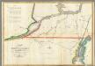
Map of the River St Lawrence and Adjacent Country.
1 : 291456 Melish, John
East End of Lake Ontario and River St. Lawrence from Kingston to French Mills.
1 : 360000 Melish, John
East End of Lake Ontario and River St Lawrence.
1 : 348480 Melish, John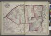
"St. Lawrence, Franklin, Clinton, and Essex"
from New topographical atlas and gazetteer of New York, comprising a topographical view of the several counties of the state, ... including ... map of the United States and territories ... Compiled from the latest astronomical observations, official surveys and records of the United States and territories ...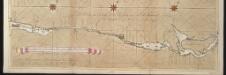
La riviere de Canada ou de St. Laurens de I. de Montreal jusqu'à le lac Ontario aux Nord de l'Amérique
Canada Gerard van Keulen
Province de New-York : en 4 feuilles / par Montrésor.
from (A-Z)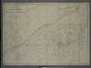
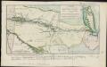
Survey of the several routes for a rail road from Ogdensburgh to Lake Champlain : made in pursuance of an act of the State of New York, passed May 14th, 1840 / by Edw H. Brodhead, chief engineer ; J.H. Jackson, H. Thomas & V. Whitney, commissrs.
from (A-Z)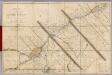
Seat of War in Lower Canada.
1 : 443520 Lay, Amos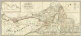
Map of the District Of Montreal, Lower Canada.
1 : 174240 Wyld, James, 1812-1887
Lower Canada.
1 : 1520640 Burr, David H., 1803-1875
East Part of Canada.
1 : 1440000 Greenleaf, Jeremiah
Lower Canada.
1 : 1440000 Greenleaf, Jeremiah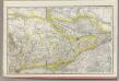
Ontario No. 2.
1 : 1110000 Rand McNally and Company
New York.
1 : 570000 Rand McNally and Company
Shell Highway Map of New York (western portion).
1 : 792000 Shell Oil Company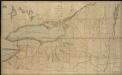
Map of the northern part of the state of New York
1 : 450000 Lay, Amos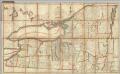
Northern Part of the State Of New York
1 : 443529 Lay, Amos