Maps of Frontier County
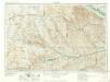
McCook
1 : 250000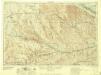
McCook
1 : 250000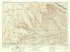
McCook
1 : 250000
Chase, Hayes, Dundy, Hitchcock.
1 : 300000 Everts & Kirk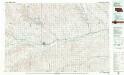
McCook
1 : 100000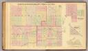
Frontier, Gosper, Red Willow, Furnas Cos.
1 : 211200 Everts & Co.
Imperial
1 : 100000
Gothenburg
1 : 100000
Gothenburg
1 : 125000
Gothenburg
1 : 125000
Culbertson SE
1 : 24000
Max SE
1 : 24000
Max
1 : 24000
Trenton SW
1 : 24000
Trenton SE
1 : 24000
Trenton SE
1 : 24000
Culbertson SW
1 : 24000
Rock Creek Lake
1 : 24000
Parks
1 : 24000
Benkelman
1 : 24000
McCook SW
1 : 24000
McCook SW
1 : 24000
McCook SE
1 : 24000
Lebanon
1 : 24000
Lebanon
1 : 24000
Lebanon
1 : 24000
Danbury
1 : 24000
Shippee
1 : 24000
Shippee
1 : 24000
Wilsonville
1 : 24000

