Maps of Grand Junction
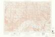
Grand Junction
1 : 250000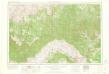
Grand Junction
1 : 250000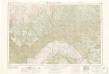
Grand Junction
1 : 250000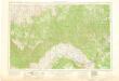
Grand Junction
1 : 250000
Grand Junction
1 : 250000
Grand Junction
1 : 250000
Grand Junction
1 : 250000
Grand Junction
1 : 100000
Westwater
1 : 100000
Westwater
1 : 100000
Douglas Pass
1 : 100000
Seep Ridge
1 : 100000
Seep Ridge
1 : 100000
Floy Canyon
1 : 62500
Sego Canyon
1 : 62500
Moonwater Point
1 : 62500
Tenmile Canyon
1 : 62500
Tenmile Canyon
1 : 62500
Roan Creek
1 : 62500
Roan Creek
1 : 62500
Roan Creek
1 : 62500
Grand Valley
1 : 62500
Grand Valley
1 : 62500
Grand Valley
1 : 62500
Firewater Canyon
1 : 62500
Firewater Canyon
1 : 62500
Firewater Canyon
1 : 62500
Highmore
1 : 62500
Highmore
1 : 62500
Highmore
1 : 62500
Parachute Creek
1 : 62500
Parachute Creek
1 : 62500
Parachute Creek
1 : 62500

