Maps of Satu Mare
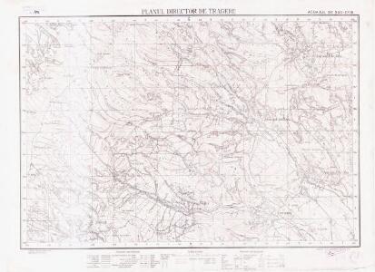
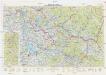
Lambert-Cholesky sheet 2778 (Asuajul de Sus)
1 : 20000 Romanian military topographic map sheet under Lambert-Cholensky projection Institutul Geografic Militar geo-spatial.org Institutul Geografic Militar
Szinyer-Varalja und Kraszna-Beltek.
from Spezialkarte der osterreichisch-ungarischen Monarchie.
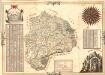
Szatmár vármegye térképe
1 : 425000 Maďarsko Kogutowicz, Manó Magyar Földrajzi Intézet
Szathmárer Comitat
1 : 280000 Satu-Mare-oblast (Rumunsko)
Szathmárer Comitat
1 : 300000 Satu-Mare (Rumunsko : oblast)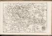
C. Szathmariensis
Rumänien Komitat Sathmar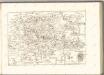

Generalkarte von Zentraleuropa
Neubertova generální automapa Republiky československé
1 : 200000 Chust (Ukrajina) Soukup, Jan V. Neubert a synové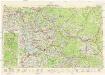
Neubertova generální automapa Republiky československé
1 : 200000 Chust (Ukrajina) Soukup, Jan V. Neubert a synové
Transilvania
Mollova mapová sbírka Hoffmann, Johannes Hoffmann, Johann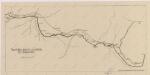
Sbírka map a diagramů použitých na mírových konferencích v Paříži v letech 1919 - 1920

Russia
Mollova mapová sbírka Hoffmann, Johannes Hoffmann, Johann
Siebenbürgen
Sedmihradsko (Rumunsko) Kipferling, Karl Joseph im Verlage des Kunst und Industrie Comptoir's
Ober Ungern
Rumunsko severní im Verlage des Kunst und Industrie Comptoirs
Ober Ungern
Rumunsko severní Ossenbrug, J. von Müller, Franz im Verlage des Kunst und Industrie Comptoirs
Vermehrte und Verbesserte Landkarten des Königreichs Ungarn :
1 : 500000 Mollova mapová sbírka Stier, Martin Böner, Johann-Alexander Endter, Martin
A Tisavölgy vizszabályozasi átnézeti térképe
Mapa Particvlaris Transilvaniae
Mollova mapová sbírka Geyer
Transylvaniae Principatus
1 : 720000 Mollova mapová sbírka Seutter, Matthäus Seutter, Matthäus
Nova Transilvaniae Principatus Tabula. Novissima descriptia editia
1 : 730000 Mollova mapová sbírka Ottens, Reinier Ottens, Josua
Principatus Transilvaniae
1 : 720000 Mollova mapová sbírka Homann, Johann Baptist Homann, Johann Baptista
Szegedin, Grosswardein, Ó Arad, Erlau, Szolnok
1 : 750000 Arad (Rumunsko) K. k. militär-geographisches Institut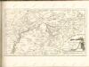

Ober Ungern
Maďarsko Ossenbrug, J. von im Verlage des Kunst und Industrie Comptoir's
Ober Ungern
Maďarsko Ossenbrug, J. von im Verlage des Kunst und Industrie Comptoir's
Übersichtskarte von Mittel - Europa

Bez titulu: Šest listů speciálních map Ukrajiny

Generalkarte Von Siebenbürgen. Nach geometrisch gemessenen Karten und andern zuverlaessigen Hilfsmitteln verjüngt, und graduirt von Herrn A. von Wenzely. Herausgegeben von Herrn F. A. Schraembl
1 : 430000 Siebenbürgen Produkt, Straßennetz Wenzely, Anton; Schraembl, Franz Anton