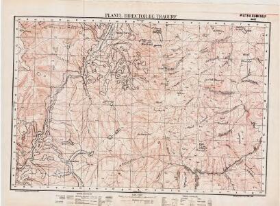
Maps of Vrancea
Lambert-Cholesky sheet 4462 (Piatra Runcului)
1 : 20000 Romanian military topographic map sheet under Lambert-Cholensky projection Direcția Topografică Militară geo-spatial.org Direcția Topografică Militară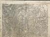
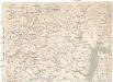
Ojtoz Pasz
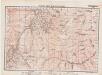
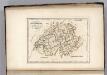
1 : 75000 Judet Bacău
Ojtoz Pasz.
from Spezialkarte der osterreichisch-ungarischen Monarchie.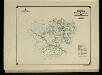
Harta Cailor de Comunicatie din Judetul Bacau
Rumänien Judeţ Bacău Verkehrsweg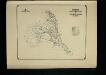
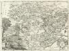
Harta Cailor de Comunicatie din Judetul Putna
Rumänien Putna Verkehrsweg
Ost-Karpathen
1 : 600000 Karpaten (Südost)
Generalkarte von Zentraleuropa

[Střední Rumunsko]
1 : 420600 Rumunsko Schraembl, Franz Anton F.A. Schraembl
Siebenbürgen
Sedmihradsko (Rumunsko) Kunst- und Industrie Comptoir
Carte de la Roumanie et pays limitrophes. Klausenbourg
1 : 500000 France. Service géographique de l'armée [Paris] : Service géographique de l'armée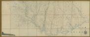
Carte de la Moldavie
1 : 330000 Moldawien, Bessarabien
Generalkarte Von Siebenbürgen. Nach geometrisch gemessenen Karten und andern zuverlaessigen Hilfsmitteln verjüngt, und graduirt von Herrn A. von Wenzely. Herausgegeben von Herrn F. A. Schraembl
1 : 430000 Siebenbürgen Produkt, Straßennetz Wenzely, Anton; Schraembl, Franz Anton
Sheet XV: Karte Des Oesterreichischen Kaiserstaates.
1 : 576000 Scheda, Josef
Übersichtskarte von Mittel - Europa

Bez titulu: Šest listů speciálních map Ukrajiny
Switzerland.
1 : 1500000 Carey, Mathew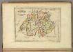
Switzerland.
1 : 1450000 Carey, Mathew
Switzerland.
1 : 1500000 Carey, Mathew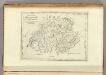
Switzerland.
1 : 500000 Carey, Mathew
Switzerland.
1 : 500000 Carey, Mathew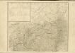

XV, uit: General-Karte des oesterreichischen Kaiserstaates mit einem grossen Theile der angrenzenden Länder / durch Josef Scheda ... bearb. und hrsg
1 : 576000 Annotatie geografische gegevens: Maatstokken: oesterreichische Meilen, geografische oder deutsche Meilen, preussische Meilen, türkische Berri, französische Lieues, russische Werste; Maatstok per blad: wiener Klafter, öster. Meilen; Blad XIX: statistische en taalkundige informatie; Blad XIX: legenda [Wien : K.K. Militärisch-Geografisches Institut]
Bez titulu: Přehledná mapa střední Evropy
Moldavia.
1 : 1800000 Mollova mapová sbírka Bruggen, Johann van der Brugge, Johannes van der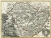
Moldavia
1 : 1800000 Mollova mapová sbírka Pfeffel, Johann Andreas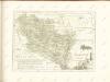

Nova et Accurata Transylvaniae
1 : 690000 Mollova mapová sbírka Valk, Gerhard Schenk, Peter I
Nova et accurata Transylvaniae
1 : 720000 Rumunsko Schenk, Pieter G. Valk et P. Schenk
Die Moldau
1 : 1000000 Moldavsko Kiepert, Heinrich Luther, Theodor Geographisches Institut