Maps of Dnieper Upland
Gouv. 24. Woronesh, 28. Slobodsk Ukraïne
1 : 2200000 1 Karte : Lithographie ; 20 x 26 cm Schlieben, W.E.A. von [Georg Joachim Göschen]
I governi di Moscovia, di Niz-Novogorod e di Kazan
1 : 4900000 1 Karte : Kupferdruck ; 22 x 31 cm Presso Pazzini Carli
Generalʹnaja karta Kavkazskago kraja / izdana pri Voennom sbornikė
1 : 1300000 1 Karte gefaltet : Lithografie ; 75 x 91 cm [Verlag nicht ermittelbar]
Gouv. 16. Wladimir, 20. Tula
1 : 2300000 1 Karte : Lithographie ; 26 x 19 cm Schlieben, W.E.A. von [Georg Joachim Göschen]
Gouv. 9. Twer, 14. Jaroslaw
1 : 2200000 1 Karte : Lithographie ; 19 x 26 cm Schlieben, W.E.A. von [Georg Joachim Göschen]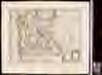
Kremlenagrad. Castellum urbis Moskvae
1 Karte : Kupferdruck ; 37 x 49 cm [Joan Blaeu]
Gouv. 32. Das Land der Donischen Kosaken
1 : 2300000 1 Karte : Lithographie ; 26 x 23 cm Schlieben, W.E.A. von [Georg Joachim Göschen]
Gouv. 18. Tambow, 19. Riaesan
1 : 2300000 1 Karte : Lithographie ; 26 x 19 cm Schlieben, W.E.A. von [Georg Joachim Göschen]
Gouv. 29. Jekatarinoslaw
1 : 2300000 1 Karte : Lithographie ; 19 x 26 cm Schlieben, W.E.A. von [Georg Joachim Göschen]
Rvssiæ, vulgo Moscovia, pars australis / auctore Isaaco Massa
1 : 3910000 1 Karte : Kupferdruck ; 38 x 51 cm Massa, Isaac Abrahamsz Apud Johan et Cornelium Blaeu
Von dem Landt Armenia dem groessern
1 : 3800000 1 Karte : Holzschnitt ; 24 x 16 cm Münster, Sebastian [Henricpetri]
Sarmatia Asie
1 : 3800000 1 Karte : Holzschnitt ; 24 x 16 cm Münster, Sebastian [Henricpetri]
Sarmatia Asie
1 : 3800000 1 Karte : Holzschnitt ; 24 x 16 cm Münster, Sebastian [Henricpetri]
Sarmatia Asie
1 : 3800000 1 Karte : Holzschnitt ; 24 x 16 cm Münster, Sebastian [Henricpetri]
Karta Raīona Largo-Kagul'skoj operacīi v 1770 g.
Moldawien Kagul Krieg
Karta teatra vojn 1769-1774 gg. i 1787-1791 gg.
Rumänien Moldawien Krieg Suvorov, Aleksandr V.
Gouv. 31 Taurien, 31a Das Land der Tschernomorskischen Kosaken
1 : 2300000 1 Karte : Lithographie ; 19 x 29 cm Schlieben, W.E.A. von [Georg Joachim Göschen]
Gouv. 12. Archangelsk
1 : 5800000 1 Karte : Lithographie ; 27 x 19 cm Schlieben, W.E.A. von [Georg Joachim Göschen]
Gouv. 6. Moskwa, 7. Smolensk, 21. Kaluga
1 : 2200000 1 Karte : Lithographie ; 19 x 26 cm Schlieben, W.E.A. von [Georg Joachim Göschen]
Gouv. 22. Orel, 23. Kursk, 26. Tschernigow
1 : 2300000 1 Karte : Lithographie ; 19 x 27 cm Schlieben, W.E.A. von [Georg Joachim Göschen]
Nouveau plan routier de la ville de St.Pétersbourg
1 : 20000 1 Karte : Kupferdruck ; 27 x 36 cm [A. Pluchart]
Partie meridionale de la Russie européenne, Tartarie russienne et petite Tartarie / Par le Sr. Robe
1 : 7500000 1 Karte : Kupferdruck ; 23 x 29 cm Dussy, E. [Delamarche]
Die Gegend zwischen Pultava und Bender Mitt Angraenzenden Polnisch, Türkisch und Tartarischen Lands
1 : 2000000 1 Karte : Kupferdruck ; 16 x 29 cm Bodenehr, Gabriel [Verlag nicht ermittelbar]
Accurata Delineatio Sinus Finnici Cronstadio Petropolin usque, una cum locis amoenis in litore ejus
1 : 70000 1 Karte : Kupferdruck ; 49 x 56 cm Seutter, Matthäus [Matthäus Seutter]
Special-Karte des Kriegsschauplatzes in Süd-Russland
1 : 420000 Rusko jižní Handtke, Friedrich C. Flemming
Li Palatinati di Braclaw

Die Gegend zwischen Pultava und Bender mit angraenzenden Polnisch, Türkisch und Tartarischen Landschaften
1 : 2640000 Poltava (Ukrajina) Bodenehr, Gabriel Gabriel Bodenehr
Tractus Borysthenis vulgo Dniepr et Niepr dicti, a Kiovia ad urbum Oczakow ubi in Pontum Euxinum se exonerat
1 : 462500 Dněpr Schenk, Pieter Valk, Gerhard P. Schenk et G. Valk