Maps of Niger
Accuratissima Germaniae tabula
1 : 2400000 1 Karte : Kupferdruck ; 47 x 56 cm [Danckerts]

La Guinee 2.
1 : 9000000 Bonne, Rigobert, 1727-1794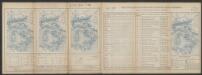
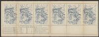
Bullettino decadico dell'osservatorio ed archivio centrale geodinamico
1 : 1200000 1885/28, Blatt 1 Archivio Centrale Geodinamico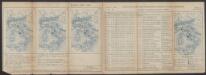
Bullettino decadico dell'osservatorio ed archivio centrale geodinamico
1 : 1200000 1885/5, Blatt 1 Archivio Centrale Geodinamico
Regna Congo et Angola. [Karte], in: Novus atlas absolutissimus, Bd. 6, S. 180.
1 Karte aus Atlas Janssonius Offizin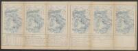
Bullettino decadico dell'osservatorio ed archivio centrale geodinamico
1 : 1200000 1885/30, Blatt 2 Archivio Centrale Geodinamico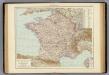
Frankreich.
1 : 3000000 Andree, Richard
Karte der Eisenbahnen Mittel-Europa's
1 : 1850000 Evropa střední Müller, H. C. Flemming
Spain and Portugal.
from New & accurate description of the earth in all its empires, kingdoms and states
Carte generale de toute l'Europe, 5
1 Blatt : 56 x 46 cm J.M. Will
[133][136] Occidentalior tractus Maris Mediterranei, uit: Atlas sive Descriptio terrarum orbis
Annotatie: Gedigitaliseerde versie. Amsterdam. Heiloo : Picturae (vervaardiger), 2015. tiff-bestand. Gedigitaliseerd: 07-01-2015; Origineel: Universiteitsbibliotheek Vrije Universiteit (XL.05127.-) ; Netherlands; Titelpagina ontbreekt Wit, Frederik de Amsterdam : Frederick de Wit
Orbis Romani pars occidentalis
1 : 10600000 Evropa západní Anville, Jean-Baptiste Bourguinon d' Küffner, Paul in officina Weigelia-Schneideriana
Sudan, Guinea.
1 : 7250000 Radefeld, Carl Christian Franz, 1788-1874
[Secunda Affrice tabula] [Karte], in: Clavdii Ptholomei Viri Alexandrini Cosmographie, S. 161.
1 Karte aus Atlas Nicolaus Germanus [und Ptolemaeus, Claudius]
Veränderungen der Karte von Europa seit 1815
1 : 3800000 Evropa Wenzel, Joh. K. J.G. Calve'sche k. k. Hof- und Universitäts-Buchhandlung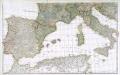
Prémière partie de la carte d'Europe contenant la France, l'Alemagne, l'Italie, l'Espagne & les isles britanniq.s, 2
1 Blatt : 53 x 85 cm s.n.
Partie occidentale de la mer Méditerranée
1 Karte : Kupferdruck ; 49 x 55 cm Robert de Vaugondy Didier Robert de Vaugondy
Spezial - karte von AfricaSektion Central-Sudân (5)
1 : 4000000 1 full d'1 mapa en 10 fulls i estoig Hermann Habenicht; Justus Perthes
Spezial - karte von AfricaSektion Central-Sahara (2)
1 : 4000000 1 full d'1 mapa en 10 fulls i estoig Hermann Habenicht; Justus Perthes
Tabula Secunda Africae [Karte], in: Claudii Ptolemei viri Alexandrini mathematice discipline philosophi doctissimi geographie opus [...], S. 184.
1 Karte aus Atlas Waldseemüller, Martin [und Ptolemaeus, Claudius] Übelin, Georg
萬國通鑑:歐羅巴洲耶穌後一千年
美国传教士撰的向中国人介绍世界地理概况的著作,后有世界地图册1份,共13幅世界、大洲和区域地图,其中一幅题为《中國地圖》的清朝内地地图。 Sheffield, Devello Zelotos 謝衛樓 福州 : 美華書局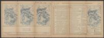
Bullettino decadico dell'osservatorio ed archivio centrale geodinamico
1 : 1200000 1886/29, Blatt 1 Archivio Centrale Geodinamico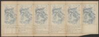
Bullettino decadico dell'osservatorio ed archivio centrale geodinamico
1 : 1200000 1886/3, Blatt 2 Archivio Centrale Geodinamico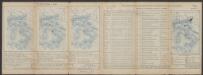
Bullettino decadico dell'osservatorio ed archivio centrale geodinamico
1 : 1200000 1885/13, Blatt 1 Archivio Centrale Geodinamico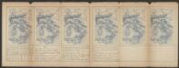
Bullettino decadico dell'osservatorio ed archivio centrale geodinamico
1 : 1200000 1886/9, Blatt 2 Archivio Centrale Geodinamico
Bullettino decadico dell'osservatorio ed archivio centrale geodinamico
1 : 1200000 1885/7, Blatt 1 Archivio Centrale Geodinamico
Tabula Geographica Europae Austriacae Generalis
1 : 1430000 Mollova mapová sbírka Homann, Johann Christoph Homann, Johann Baptista - dědici
Bullettino decadico dell'osservatorio ed archivio centrale geodinamico
1 : 1200000 1885/14, Blatt 2 Archivio Centrale Geodinamico