Maps of Pontic Steppe
Dacia Or., Sarmatia, Caucasus, Scythia Int. Imaum / J.E. Knittel sculps
1 : 5100000 1 Karte : Kupferdruck ; 45 x 58 cm Campe, Friedrich Campius
Secunda Asie Tabula [Karte], in: [Clavdii Ptholomei Cosmographi ...], S. 302.
1 Karte aus Atlas Nicolaus Germanus [und Ptolemaeus, Claudius]
Tabula Asiae II. [Karte], in: Geographia universalis vetus et nova complectens Claudii Ptolemaei Alexandrini enarrationis libros VIII, S. 269.
1 Karte aus Atlas Münster, Sebastian [und Ptolemaeus, Claudius]
[Secunda Asie tabula] [Karte], in: Clavdii Ptholomei Viri Alexandrini Cosmographie, S. 167.
1 Karte aus Atlas Nicolaus Germanus [und Ptolemaeus, Claudius]
Anbau u. Juli-Jsothermen
Russland / Europäischer Teil Pflanzenbau, Klima
Secunda Asiae Tabula [Karte], in: Claudii Ptolemei viri Alexandrini mathematice discipline philosophi doctissimi geographie opus [...], S. 196.
1 Karte aus Atlas Waldseemüller, Martin [und Ptolemaeus, Claudius] Übelin, Georg
Map illustrating ancient Russian history
Russland Kiewer Reich Philip, George ; Philip, [Sohn v. G.]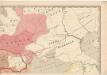
Evropa raného středověku: do konce VI. století po Kr.
Kašpar, Jan
Ruszland, Regenmenge u. Januar-Jsothermen
Russland / Europäischer Teil Pflanzenbau, Klima
Sarmatia.
1 : 22000000 Fenner, Rest.
Schiffbare Flüsse u. Kanäle
Russland / Europäischer Teil Wasserstraße
Karte des Europaeischen Russlands
Neuester Schul-Atlas Walch, Johann im Verlag bei Joh. Walch
Das europæische Russland nach seiner allmähligen Vergrösserung seit 1462
1 : 38500000 Russland / Europäischer Teil Expansion
Composite: Das Russische Reich in Europa.
1 : 4475000 Stein, Christ. Gottfr. Dan.
Karta rossijskich želěznych dorog
1 : 5250000 Charkov-oblast (Ukrajina) Bangof, Eduard v artističeskom zavedenija A.F. Marksa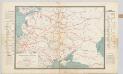
Spoorwegkaart van Rusland / naar de nieuwste bronnen vervaardigd door J. Pik
1 : 2500000 Annotatie: Met informatie over Russische spoorwegmaatschappijen en over het Russische geld; Annotatie geografische gegevens: Met drie maatstokken: Duitsche mijlen, Kilometers en Wersten J. Pik Groningen : De Financier
Nord- und Ost-Europa bis zur letzten Theilung Polens 1795
1 : 14000000 Nordeuropa, Osteuropa, Teilungen Polens
Des europäischen Russlands südlicher Theil
Allgemeiner Atlas [Walch, Johannes] im Verlag bei Johannes Walch
Europäisches Russland 1801-1855
1 : 15500000 Russland / Europäischer Teil
Verbreitung der Slaven um 1900
Osteuropa Slawen Anton, J.
Karta želěznych dorog Rossijskoj imperiji
1 : 1200000 Moskva-oblast (Rusko) izdanije Kartografičeskago zavedenija A. Il'jina
Carte de la partie européenne de l'empire de Russie, avec l'indication des chemins de poste, ainsi que des douanes frontières et de la repartition actuelle en gouvernements et districts
1 : 3000000
Mineralien
Russland / Europäischer Teil Mineralischer Rohstoff
Das Russische Reich in Europa
1 : 8043000 Rusko západní Streit, Friedrich Wilhelm Leutemann, H. J.C. Himrichs'sche Buchhandlung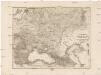
Dacia or., Sarmatia, Caucasus, Scythia int. Imaum
1 : 800000 Dácie Reichard, Christian Gottlieb Campius, D. a D. Campio
Die allmähliche Bildung des Russischen Reiches vom Untergang des Freistaates Nowgorod 1478 bis zum Jahre 1715
Rusko Gindely, Antonín F. Tempsky
Die allmähliche Bildung des Russischen Reiches vom Untergang des Freistaates Nowgorod 1478 bis zum Jahre 1715
Rusko západní Gindely, Antonín F. Tempsky
Russisches Reich. Verwaltungsgrenzen von 1914. Europäischer Teil
Russland / Europäischer Teil Verwaltungsgliederung
Charte von dem europaischen Russland
1 : 9400000 Rusko západní Streit, Friedrich Wilhelm