Maps of Southern Finland

Sinus Finnici delineatio geographica / ex quam plurimis subsidiis novissimis stereographice tradita
1 : 1000000 1 Karte auf 2 Blatt : Kupferdruck ; 44 x 81 cm Mayer, Tobias [Homännische Erben]
Nieuwe kaart van de Finnissche Golf benevens de omliggende provintien : naar de beste kaarten en sterrekundige waarnemingen geteekend in 't Konigl. Landmeeters Comtoir te Stockholm
1 : 1200000 C. van Baarsel sculp. te Amsterdam : bij J. Covens en Zoon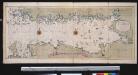
Nieuwe afteekening van de Finlandse Golff
Gulf of Finland Abraham Maas Gerard van Keulen
Oost-Zee Streckende van Dageroort tot Wyborgh [Karte in 2 Teilen], in: De Nieuwe Groote Vermeerderde Zee-Atlas ofte Water-Werelt, S. 27.
1 Karte aus Atlas Doncker, Hendrick
Tammerfors, Helsingfors, Reval
1 : 750000 Helsinky (Finsko) K. u. k. Militärgeographisches Institut
Nova et accurata delineatio Ingriae et Careliae cum magna parte Sinus Finnici et Lacus Ladogae, nec non insularum adjacentium
1 : 1210000 Finsko Seutter, Matthäus Matthaeus Seutter
Die finnischen Seen
Finnland Seengebiet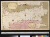
Afteekening van t agterste gedeelte van de Oost Zee van t eijlant Dago tot Schansternij
Gulf of Finland Gerard van Keulen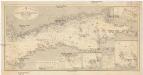
Ostsee
1 : 400000 Baltské moře Reichs-Marine-Amt
Afteekening van de Oostzee of Oost Finsche Boodem vertoonende de vaart van Revel tot St. Petersburgh int groot
Gulf of Finland Gerard van Keulen
Kronstadt, Wiborg, Wesenberg
1 : 750000 Kronštadt (Rusko) K. u. k. Militärgeographisches Institut
Trigonometrisk grunnlag, vedlegg 65, 10-13: Grunnlagspunkter for Struves meridianbue fra Finnland og Estland
1 : 200000 de Struve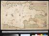
Afteekening van de Finsche Boodem in de Ost Zee of vaarweg van 't Hoogland tot voor St. Petersborgh
Gulf of Finland Gerard van Keulen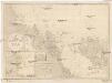
Ostsee
1 : 200000 Alandské ostrovy (Finsko : souostroví) Reichs-Marine-Amt
Die finnischen Schären
1 : 2000000 Finnland Schärenküste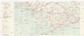
Finnland Straßenkarte
1 : 200000 Finsko Gen St d H Abt f Kr Kart u Verm W IV Mil Geo
[Suomi tiekartta 1:200 000]
1 : 200000 Finsko
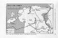
Der Kampf um Petrograd (Oktober 1919)
Russland (Nordwest) Russischer Bürgerkrieg <1917-1921>
INGRIA.
[Amsterdam : Joan Blaeu]
Finnische Schärenküste
1 : 2000000 Finnland Schärenküste
Der Kampf um Petrograd (August 1919)
Russland (Nordwest) Russischer Bürgerkrieg <1917-1921>
Ingermanlandiae seu Ingriae novissima tabula / luci tradita per Homannianos Heredes
1 : 390000 1 Karte : Kupferdruck ; 46 x 55 cm Rostovčev, Aleksej Ivanovič Homännische Erben
Ducatus Uplandia. [Karte], in: Le théâtre du monde, ou, Nouvel atlas contenant les chartes et descriptions de tous les païs de la terre, Bd. 1, S. 61.
1 Karte aus Atlas Blaeu, Willem Janszoon und Blaeu, Joan Blaeu, Willem Janszoon
Ducatus Uplandia. [Karte], in: Novus Atlas, das ist, Weltbeschreibung, Bd. 1, S. 49.
1 Karte aus Atlas Blaeu, Joan Blaeu, Willem Janszoon
Nova et accurata delineatio Ingriae et Careliae cum magna parte sinus Finnici et lacus Ladogae, nec
1 : 610000 1 Karte : Kupferdruck ; 55 x 47 cm Seutter, Matthäus [Matthäus Seutter]
DVCATVS | VPLANDIA.
Joh. et Cornelius Blaeu exc.
Ingermanlandiae seu Ingriae novissima tabula
1 : 390000 Petrohrad (Rusko) per Homannianos heredes
Ducatus Uplanida. [Karte], in: Theatrum orbis terrarum, sive, Atlas novus, Bd. 1, S. 61.
1 Karte aus Atlas Blaeu, Joan Blaeu, Willem Janszoon