Maps of Belarus

Li palatinati di Minsk, Mscislaw, Polok, e Witebsk nella Littuania / tratta dall'atlante polacco del
1 : 1400000 1 Karte : Kupferdruck ; 40 x 30 cm Zuliani, Giuliano presso Antonio Zatta
Charte von Russisch Litauen
1 : 1320000 Bělorusko auf Kosten der Homännischen Erben
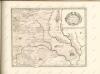
Charte von Russisch Litauen
1 : 1320000 Bělorusko auf Kosten der Homännischen Erben
Charte von Russisch Litauen
1 : 1320000 Bělorusko auf Kosten der Homännischen Erben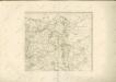

Delineatio memorabilis conflictus et victoriae Lithuanorum Duce Radivilio de Cricevio
Bělorusko
Castra defensiva Ducis Radiuly Reciciae, obiecta aduentui Eliae Bohaczenlio
Bělorusko
Kijew, Žitomir, Owrucz, Czernobyl, Mozyr, Łojew
1 : 750000 Kyjev (Ukrajina : oblast) Korb, L. K. u. k. Militärgeographisches Institut
Bobrujsk, Czerikow, Str. Szkłow
1 : 750000 Bobrujsk (Bělorusko) Dornhofer, J. K. u. k. Militärgeographisches Institut
Bobrujsk, Czerikow, Str. Szkłow
1 : 750000 Bobrujsk (Bělorusko) K. k. militär-geographisches Institut
Kijew, Žitomir, Owrucz, Czernobyl, Mozyr, Łoiew
1 : 750000 Kyjev (Ukrajina : oblast) K. k. militär-geographisches Institut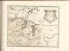

Strategische Übersichts-Karte des polnisch-litaurischen Armee-Bewegungraumes

Übersichtskarte von Mittel - Europa

Raspoloženīe vojska 1. ījulja.
Litauen Weißrussland Russlandfeldzug <1812>
Übersichtskarte von Mittel - Europa

Wilna, Minsk, Grodno, Słonim
1 : 750000 Grodno (Bělorusko : oblast) Jakupec, M. K. u. k. Militärgeographisches Institut
Wilna, Minsk, Grodno, Słonim
1 : 750000 Grodno (Bělorusko : oblast) K. k. militär-geographisches Institut
Połock, Witebsk, Smolensk
1 : 750000 Polack (Bělorusko) K. u. k. Militärgeographisches Institut
Wiłkomierz, Dwinsk (Dünaburg), Wilna, Wilejka, Słonim, Mińsk
1 : 300000 Minsk (Bělorusko : oblast)
Dviženīe 1j i 2j armīi k Smolensku.
Russland Smolensk Russlandfeldzug <1812>
Zdzienciol, Gorodischtsche, Derewna, Ljachowitschi
1 : 100000 Bělorusko
Operacīja Petra Velikago protiv Levengaupta.
Europa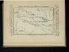
Karta di’jstvij ot‘‘ Bereziny k‘‘ Vil’ně
Litauen Vilnius Russlandfeldzug <1812>
Poland, Western Russia, Latvia and Lithuania [A map of]
This is sheet 322 of a series of maps was prepared for the German Army, and its numeration continues that of the Karte des Deutschen Reiches. Grossblatt 308-441A. [A map of Poland, western Russia, Latvia, and Lithuania, drawn in extension of the Karte des Deutschen Reiches 1:100,000 published by the Reichsamt für Landesaufnahme.]. Germany. Heer. Abteilung für Kriegskarten- und Vermessungswesen. [S.l.] : Hergestellt im Auftrage Gen St d H Abt f Kr Kart u Verm Wes (II)
Rußland 1:50 000
1 : 50000 Rusko západní OKH
Rußland 1:50 000
1 : 50000 Bělorusko OKH
Rußland 1:100 000
1 : 100000 Rusko západní OKH