Maps of United Kingdom

Carte generale de toute l'Europe, 1
1 Blatt : 57 x 48 cm J.M. Will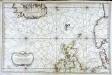
Carte réduite de partie de la mer du Nord comprise entre l'Ecosse, le Dannemark, la Norwege et l'Islande
1 Karte : Kupferdruck ; 55 x 83 cm Bellin s.n.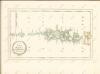
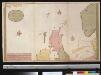
Nieuwe paskaert vant Noorderdeel der Noord Zee als meede een gedeelte van de West cust van Schotlant en Irland seer dienstigh voor de kruijsers op de Oostindise scheepen
Scotland Gerard van Keulen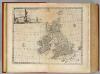
Great Britain & Ireland.
1 : 4250000 Bowen, Emanuel
British Islands.
1 : 2300000 Lizars, Daniel
Novissima præ cæteris aliis accuratissima regnorum Angliæ, Scotiæ Hiberniæq[ue] tabula
1 Karte : Kupferdruck ; 57 x 48 cm Wit I. Cóvens et C. Mortier
Novissima præ cæteris aliis accuratissima regnorum Angliæ, Scotiæ Hiberniæ tabula
1 Karte : Kupferdruck ; 56 x 48 cm Schenk Pieter Schenk
Les isles Britanniques ou sont les royaumes d'Angleterre d'Escosse et d'Irlande [et]c
1 Karte : Kupferdruck ; 59 x 48 cm Nolin chez I. B. Nolin geographe de S. A. R. M.r sur le quay de l'Horloge du Palais a l'enseigne de la place des Victoires
Novissima præ cæteris aliis accuratissima regnorum Angliæ, Scotiæ Hiberniæq[ue] tabula
1 Karte : Kupferdruck ; 58 x 48 cm Wit F. de Wit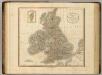
British Isles.
1 : 2550000 Cary, John, ca. 1754-1835
United Kingdom of England, Scotland and Ireland.
1 : 4500000 Worcester, J. E.
Great Britain and Ireland.
1 : 4100000 Gray, Ormando Willis
Iles Britanniques.
1 : 2470000 Levasseur, E.
Petit Neptune anglois ou carte marine des côtes d'Angleterre, d'Ecosse et d'Irlande
1 Karte : Kupferdruck ; 65 x 50 cm Bonne; Lattré; Marillier; Berthault chez Lattré graveur rue St. Jacques près la fontaine St. Severin à la ville de Bordeaux
Royaume Uni, Angleterre, Ecosse, et Irlande 1603 a 1839.
1 : 4500000 Houze, Antoine Philippe
Great Britain and Ireland. .
1 : 3380000 Sharpe, J.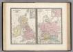
Iles Britanniques et Germanie Anciennes.
Levasseur, E.
Grossbritannien und Ireland

Angleterre, Irelande & Ecosse 1281 a 1400.
1 : 4500000 Houze, Antoine Philippe
Grossbritannien, Ireland.
1 : 3800000 Flemming, Carl
Parliamentary map, British Isles.
1 : 1774080 Stanford, Edward
Isles britanniqves
1 Karte : Kupferdruck ; 23 x 18 cm Sanson; Winter s.n.
Angleterre, Ecosse, Irlande et Man en 1100.
1 : 4500000 Houze, Antoine Philippe
Bretagne Anglo Saxonne, 600 ans apres Jesus Christ.
1 : 4500000 Houze, Antoine Philippe
Comparative Size of Lakes and Islands.
Colton, G. Woolworth
Industrial map of the British Islands
1 : 1200000 Shetlandy (Skotsko) Hughes, W. George Philip & Son
Map of the British Isles.
1 : 3500000 Warner & Beers
British Isles.
1 : 4100000 Cornell, S. S. (Sarah S.)
Iles Britanniques, chemins de fer, canaux.
1 : 2700000 Garnier, F. A., 1803-1863
Iles Britanniques.
1 : 2900000 Garnier, F. A., 1803-1863
British Isles.
1 : 9300000 Fenner, Rest.
Gt. Britain, Ireland.
1 : 1800000 Robert Laurie & James Whittle


