Maps of British Isles
Erster Theil der Karte von Europa, welcher Frankreich, Deutschland, Italien Spanien, England, Scotland und Ireland enthælt, 1
1 Blatt : 53 x 83 cm F.A. Schrämbl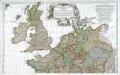
Prémière partie de la carte d'Europe contenant la France, l'Alemagne, l'Italie, l'Espagne & les isles britanniq.s, 1
1 Blatt : 53 x 84 cm s.n.
[Nord- und Istsee]
Atlas der Hydrographie Berghaus, Hermann Justus Perthes
Nord- und Ostseeherrschaft I: Reich Knuts des Großen
1 : 12000000 Nordeuropa Knud II., Danmark, Konge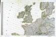
Carte d'Europe ou sont tracées les limites des empires, royaumes, et etats souverains, feuille 3
1 Blatt : 65 x 95 cm Semen etc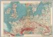
Western Europe. Pergamon World Atlas.
1 : 5000000 Polish Army Topography Service
[Einwanderung in Reval 1639-1710)
Reval Einwanderung Essen, Nicolai v. ; Eichhorn, Nicolai
Erdkarte zur Übersicht des Kolonialbesitzes, der konsularischen und
1 : 50000000 Kiepert, Richard ; Limpricht, Max Geographische Verlagshandlung Dietrich Reimer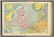
North Sea.
1 : 5000000 Philip, George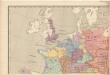
Evropa raného středověku: do konce VI. století po Kr.
Kašpar, Jan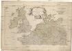
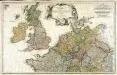
Erster Theil der Karte von Europa
1 : 2850000 Anglie Anville, Jean-Baptiste Bourguinon d' Schraembl, Franz Anton F.A. Schraembl
Erster Theil der Karte von Europa
1 : 2850000 Anglie Anville, Jean-Baptiste Bourguinon d' Schraembl, Franz Anton F.A. Schraembl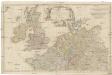
Erster Theil der Karte von Europa
1 : 2850000 Anglie Anville, Jean-Baptiste Bourguinon d' Schraembl, Franz Anton F.A. Schraembl
Tabula Nova Hibernie Anglie Et Scotie [Karte], in: Claudii Ptolemei viri Alexandrini mathematice discipline philosophi doctissimi geographie opus [...], S. 236.
1 Karte aus Atlas Waldseemüller, Martin [und Ptolemaeus, Claudius] Übelin, Georg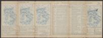
Tabula Europae I. [Karte], in: Claud. Ptolemaeus. Geographia lat. cum mappis [...], S. 254.
1 Karte aus Atlas Münster, Sebastian [und Ptolemaeus, Claudius]
Tabula Europae I. [Karte], in: Geographia universalis vetus et nova complectens Claudii Ptolemaei Alexandrini enarrationis libros VIII, S. 222.
1 Karte aus Atlas Münster, Sebastian [und Ptolemaeus, Claudius]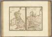
Iles Britanniques anciennes, Germanie ancienne, Rhetie, Pannonie, Norique.
1 : 3800000 Brue, Adrien Hubert, 1786-1832
[123][126] Pascaert vande Noort-Zee om achter Yrland en Schotland om te seylen, uit: Atlas sive Descriptio terrarum orbis
Annotatie: Gedigitaliseerde versie. Amsterdam. Heiloo : Picturae (vervaardiger), 2015. tiff-bestand. Gedigitaliseerd: 07-01-2015; Origineel: Universiteitsbibliotheek Vrije Universiteit (XL.05127.-) ; Netherlands; Titelpagina ontbreekt Wit, Frederik de Amsterdam : Frederick de Wit
Westeuropa 1914
Westeuropa Kunz, Andreas ; Röss, Wolf ; Johnen, Bettina ; Moeschl, Joachim Robert
Westeuropa 1890
Westeuropa Kunz, Andreas ; Röss, Wolf ; Johnen, Bettina ; Moeschl, Joachim Robert
Westeuropa 1957
Westeuropa Kunz, Andreas ; Treiling, Thomas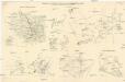
Skizzen zu den größeren Manövern der fremden Armeen 1906
Francie Streffleur, Valentin Ritter von L. W. Seidel & Sohn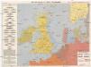
Kriegskarte der Nordsee
1 : 3350000 Severní moře-oblast Max Freissler
Westeuropa 1922
Westeuropa Kunz, Andreas ; Treiling, Thomas
Westeuropa 1937
Westeuropa Kunz, Andreas ; Treiling, Thomas
Westeuropa 1820
Westeuropa Kunz, Andreas ; Röss, Wolf ; Johnen, Bettina ; Moeschl, Joachim Robert
Westeuropa 1949
Westeuropa Kunz, Andreas ; Treiling, Thomas
[Einwanderung in Reval 1710-1786)
Reval Einwanderung Gebauer, Victor
Westeuropa 1861
Westeuropa Kunz, Andreas ; Röss, Wolf ; Johnen, Bettina ; Moeschl, Joachim Robert


