Maps of Mediterranean Sea
Carte generale de toute l'Europe, 3
2 Blätter : 56 x 90 cm J.M. Will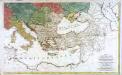
Carte générale de toute l'Europe, 2
2 Blätter : 57 x 93 cm T.C. Lotter
Osmanisches Reichs.
1 : 11800000 Radefeld, Carl Christian Franz, 1788-1874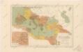
Říše římská ve své největší rozsáhlosti

Gemaelde des Roemischen Reichs in seiner grösten Ausdehnung
Historisch-genealogisch-geographischer Atlas von Le Sage Las Cases, Emmanuel Auguste Dieudonné Marius Joseph de Johann Velten, Kunsthändler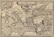
Argonautica. [Karte] [Europa.], [Thessalia und Umgebung], [Hellespontus, Phryxeum aequor, et Athamantidis fluenta.] [3 Nebenkarten], in: Theatrum orbis terrarum, S. 538.
1 Karte aus Atlas Ortelius, Abraham Vrients, Jan Baptista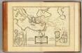
Nouveau Testament, regions, lieux.
1 : 10200000 Bonne, Rigobert, 1727-1794
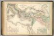
[Das Mittellaendische und Schwarze Meer. Auch als General Karte des Osmanischen Reichs]
Hand-Atlas über alle Theile der Erde nach dem neuesten Zustande und über das Weltgebäude Stieler, Adolf bei Justus Perthes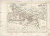
Das Römische Reich unter Traianus
starověký Řím
Das Römische Reich in der Kaiserzeit
starověký Řím Gindely, Antonín F. Tempsky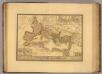
Empire Romain sous Theodose.
1 : 11300000 Picquet, C.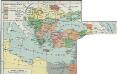
I. Osmanisches Reich bis 1683
1 : 28000000 Osmanisches Reich Expansion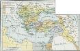
Osmanisches Reich bis 1683
1 : 18000000 Osmanisches Reich Expansion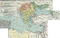
II. Rückgang des Osmanischen Reichs (Orientalische Frage) seit 1683
1 : 28000000 Osmanisches Reich
A map of the eastern part of the Roman empire
1 Karte : Kupferdruck ; 39 x 42 cm s.n.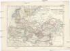
Übersichts-Karte der nach der Völkerwanderung entstandenen neuen Reiche
Afrika severní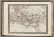
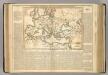
Empire Romain.
1 : 14400000 Monin, C.V.
TABLEAU DE L'EMPIRE ROMIN
Afrika severní Las Cases, Emmanuel-Auguste-Dieudonné Didot, Pierre Jules Didot Ainé
[Das Mittellaendische und Schwarze Meer, Auch als General Karte des Osmanischen Reichs]
Hand-Atlas über alle Theile der Erde nach dem neuesten Zustande und über das Weltgebäude Stieler, Adolf bei Justus Perthes
Uebersichts-Karte des Russisch - Türkischen Kriegsschauplatzes
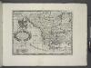
A new map of Turky in Europe and parts adjoyning shewing their principal divisions and chief cities, towns, rivers, mountains &c.
from A new sett of maps both of antient and present geography : wherein not only the latitude and longitude of many places are corrected according to the latest observations, but also the most remarkable differences of antient and present geography may be quickly discern'd by a bare inspection or comparing of correspondent maps, which seems to be the most natural and easy method to lead young students (for whose use the work is principally intended) unto a competent knowledge of the geographical science : together with a geographical treatise particularly adapted to the use and design of these maps / by Edward Wells, M.A. and student of Christ-Church, Oxon.
Carte de l’Empire des Goths, au 4e siècle de notre ère, à l’époque de l’arrivée des Huns et de leurs établissements entre l’Oural et le Don
Russland Ural Don Gotenreich Völkerwanderungszeit
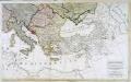
Übersichts - Karte des Türkischen Reichs in Europa und Asien
Map of the Incursions of the Barbarians.
1 : 13300000 Lavoisne, M.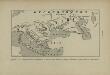
L’Europe Nord-Orientale au 5e siècle avant notre ère, d’après Hérodote
Europa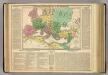
Roman Empire.
1 : 13400000 Lavoisne, M.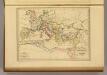
Empire Romain sous Constantin et sous Trajan.
1 : 17200000 Malte-Brun, Conrad, 1775-1826
Střední Evropa a Přední Asie za časů III. války křížové

Turkey, in Europe and Hungary, from the best authorities.
from Carey's general atlas, improved and enlarged : being a collection of maps of the world and quarters, their principal empires, kingdoms, &c.