Maps of Worcestershire

An accurate map of the county of Worcester
1 Karte : Kupferdruck ; 51 x 68 cm Bowen; Tinney; Bowles; Sayer; Bowles; Bowles sold by I. Tinney at the Golden Lion and R. Sayer at the Golden Buck in Fleet street T. Bowles in St. Pauls Church Yard and I. Bowles and son at the Black Horse in Cornhill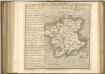

Kidderminster - OS One-Inch Map
1 : 63360 Topographic maps Ordnance Survey Ordnance Survey
Birmingham - OS One-Inch Map
1 : 63360 Topographic maps Ordnance Survey Ordnance Survey
Ordnance Survey of England. Sheet 168, Birmingham
1 : 63360 Ordnance survey. GB Southampton : Ordnance Survey Office

Birmingham (Hills) - OS One-Inch Revised New Series
1 : 63360 Topographic maps Ordnance Survey Ordnance Survey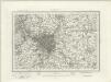
Birmingham (Outline) - OS One-Inch Revised New Series
1 : 63360 Topographic maps Ordnance Survey Ordnance Survey
Redditch (Hills) - OS One-Inch Revised New Series
1 : 63360 Topographic maps Ordnance Survey Ordnance Survey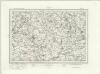
Redditch (Outline) - OS One-Inch Revised New Series
1 : 63360 Topographic maps Ordnance Survey Ordnance Survey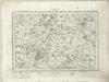
Stratford on Avon (Outline) - OS One-Inch Revised New Series
1 : 63360 Topographic maps Ordnance Survey Ordnance Survey
Stratford on Avon (Hills) - OS One-Inch Revised New Series
1 : 63360 Topographic maps Ordnance Survey Ordnance Survey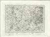
Dudley (Outline) - OS One-Inch Revised New Series
1 : 63360 Topographic maps Ordnance Survey Ordnance Survey
Dudley (Hills) - OS One-Inch Revised New Series
1 : 63360 Topographic maps Ordnance Survey Ordnance Survey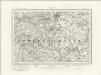
Droitwich (Outline) - OS One-Inch Revised New Series
1 : 63360 Topographic maps Ordnance Survey Ordnance Survey
Droitwich (Hills) - OS One-Inch Revised New Series
1 : 63360 Topographic maps Ordnance Survey Ordnance Survey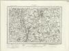
Worcester (Outline) - OS One-Inch Revised New Series
1 : 63360 Topographic maps Ordnance Survey Ordnance Survey
Worcester (Hills) - OS One-Inch Revised New Series
1 : 63360 Topographic maps Ordnance Survey Ordnance Survey
Stourbridge
1 : 31680 This plan covers parts of Worcestershire and Warwickshire. Hills and reliefs are illustrated by a combination of brushwork interlining ('hachures'), layering of colour washes and the use of aerial perspective. Tollroads are highlighted in buff and milestones noted along their routes. Stevens, Henry
Kidderminster
1 : 31680 This plan covers North Worcestershire and parts of Shropshire and Staffordshire. The draughtsman used different shades of green wash to distinguish woods, meadows, commons and parks. The Severn Valley extends down the left-hand side of the map, with the royal hunting forest of Wyre depicted at middle-left. To the right of the sheet is the Stour Valley, with the Staffordshire and Worcestershire Canal following the river valley. Rising above the two valleys is the ancient settlement of Kinver Edge, with its outcrops of red weathering sandstone formed in the Triassic age. Stevens, Henry
Tardebigge
1 : 31680 .This map covers part of Worcestershire., The right-hand boundary of the plan is formed by a Roman road, Ikenild Street., Another such road, the Salt Way, is drawn across the middle of the sheet., In Roman times, this road connected the salt mines at Droitwich,,near the top right, with Alcester, at the bottom. .Outside Alcester is Ragley Hall, designed in 1680 by Robert Hooke (1635-1703), the eminent natural philosopher and Surveyor of the City of London after the Great Fire of 1666., The landscaped gardens were added in the 18th century by Lancelot 'Capability' Brown (1716-1783) - so called because he often told prospective clients that their gardens had "great capabilities"., Brown and his followers revolutionised parkland design, virtually inventing the English parkland as we know it today, with carefully planned vistas of grassland, trees and lakes. Dawson, Robert
Pershore
This plan, covering parts of Worcestershire and Gloucestershire, shows the River Avon Valley near the centre of the sheet. The valley is characterised by meadows and wetlands. Moorings along the river course are indicated between Pershore and Evesham. Dawson, Robert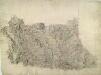
Worcester
1 : 31680 This plan uses different shades of green wash to distinguish woods, meadows, commons and parks. The valley of the River Severn is depicted down the middle of the sheet, flowing through the cathedral city of Worcester. Here, in its middle course, the river becomes deeper and wider, forming a floodplain where crops such as wheat and barley are grown. To the right of the sheet is the Droitwich Canal, a broad-beam canal running five and three-quarter miles past waterside mills from Droitwich Junction to the River Severn. Dawson, Robert
Actual survey of the county of Salop, 4
1 Blatt : 71 x 53 cm John Rocque
New map of the county of Hereford, 2
1 Blatt : 71 x 58 cm s.n.
Chipping Camden
1 : 31680 This plan covers parts of Warwickshire and Worcestershire, with the Severn Valley depicted in the middle. The River Avon meanders north-eastwards from Tewkesbury (where it meets the River Severn) to Stratford on Avon, where, after 17 locks, it joins the Stratford-on-Avon Canal. Below the Avon, near the bottom of the sheet, the Cotswolds form a dramatic limestone escarpment above the Severn Valley and Evesham Vale. Jurassic limestone, used as a building material throughout the area, gives the Cotswolds its distinctive look. Dawson, Robert
Actual Survey of the County of Salop
Rocque, John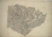
Henley-in-Arden
1 : 31680 This plan covers parts of Warwickshire and Worcestershire. Hill contours are described by brushwork interlining ('hachuring') combined with shaded bands of colour wash, which graduate to almost colourless at the summits. The order of ascending heights is expressed by rising numbers, a technique that became known as 'relative command'. Colour washes and symbols distinguish woods, meadows, common and arable land. Dawson, Robert
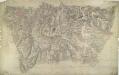
Great Malvern
1 : 31680 This plan of part of Worcestershire uses different shades of green wash to distinguish woods, meadows, commons and parks. To the left of the manuscript, the narrow ridge of the Malvern Hills rises above the Severn and Tern Valleys. At the centre of the drawing is a north-south ridge formed of igneous rock, with wooded hills rising abruptly above the Tern Valley to the north. There are gentler and more sweeping slopes to the south-west, and clusters of conifers, limes, oaks and other parkland trees to the south. Dawson, Robert