Maps of Southwark

Nouvelle carte du gouvernement civil d'Angleterre et de celuy de la ville de Londres
2 Karten : Kupferdruck ; Bildgrösse 35 x 45 cm Châtelain s.n.
London.
1 : 19495 Letts, Son & Co.
To Martin Folkes esq.r, president of the Royal Society : this plan of the cities of London and Westminster and borough of Southwark, with the contiguous buildings is humbly inscribed
1 : 15000 Rocque, John, d. 1762 John Pine ; John Tinney, print and map sellar
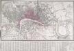
General Plan for Trusts of the Turnpike Gates
Cary, John
London [11], uit: Geognostische Karte des Oesterreichischen Kaiserstaates mit einem grossen Theile Deutschland's u. Italien / hauptsachlich nach ... Haidinger's geognostischer Karte dieses Staates bearb. von Josef Scheda
1 : 3000000 titelvariant: General-Karte von Europa in 25 Blättern; Annotatie: Bijlage bij: General-Karte von Europa in 25 Blättern. - 1:2.592.000. - 1845-1847 Scheda, Joseph Wien : K.K. Militär. Geografisch. Institut
The stranger's guide to London and Westminster exhibiting all the various alterations and improvements, complete to the present time
Mogg, Edward Edward Mogg
BOWLES'S NEW PLAN OF LONDON, WESTMINSTER AND SOUTHWARK, WITH THEIR ENVIRONS TO THE EXTENT OF THREE MILES ROUND ST. PAUL'S
The Bowles family were prolific publishers and their output spans more than a century. This map is relatively unusual as it is presented in a circle. The map is divided by lines into square miles. In the margins of the sheet are reference tables and adverts for coming publications. Baker Street, laid out from 1755 on, is shown by a pecked line, as is Gloucester Street. Carington Bowles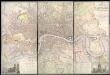
Map of LONDON From Actual Survey COMPREHENDING THE Various Improvements to 1851HUMBLY DEDICATED TO Her Most Gracious Majesty QUEEN VICTORIA By the Proprietors E. RUFF & Co.
This is a later edition of the Greenwoods' map of London first issued in 1827. Set within a decorative border, the map features title at top right, view of Westminster Abbey with key to symbols and colours at bottom left and view of St. Paul's Cathedral with reference table at bottom right. Greenwood, Christopher and John
NEW PLAN OF LONDON AND THE ENVIRONS from an Original Survey EXTENDING 6 3/4 Miles North & South in which all New and Intended Buildings and Improvements are carefully Inserted
This folding map is set within a decorative border. The title and imprint feature at top right, the compass star at middle right, and scale bar at bottom left. The river, open spaces and the built-up area in the city are delineated in colour. This is the fourth edition of a map first issued by Thompson in 1823, updated with the addition of St. Katherine's Dock and the housing developments in the Marylebone and Mile End areas. Thompson, George
CRUCHLEY'S NEW POSTAL DISTRICT MAP OF LONDON
This map shows the division of London into ten post codes. The title appears along the top, with the publisher's imprint below the plan and a scale bar at bottom left. Also on the map are the Metropolitan Railway line to Finsbury, the proposed site of Charing Cross station (built in 1864) and the planned London, Chatham and Dover line. Cruchley, George Frederick
Cary's new plan of London and its vicinity
Cary, John; Cary, George Cary
Map of London, shewing the BOUNDARIES of the GENERAL and Two Penny Post
This outline map of London was commissioned by the House of Commons for the21st Report of the Commissioners of Revenue Inquiry in 1830. The map's title features at top right, with the boundaries of the nine postal districts and those of the General-, Two- and Three-Penny Post deliveries outlined in colour. Boundaries are explained at top left with a key to colour usage in panel below the plan. Basire, James
Londini Angliae regni metropolis delineatio accuratissima / autore F. de Witt
1 : 13000 Wit, Frederik de Amsterdam : F. de Witt
LONDON AND WESTMINSTER 1795
This is the second edition of a map published seven times until 1806. The title is embellished with an engraving of Father Thames, with St Paul's visible in the distance to one side of him. This edition includes an inset plan of the proposed Wet Docks. In 1796, the year this map was published, a Parliamentary Committee attempted to resolve the docking problems such as congestion, delays, lack of warehouse space and theft. The result was a number of project proposals for the building of new docks. However, none of these proposals were carried out, and the problem was not solved until private companies began building enclosed docks in 1802. Fairburn, John
LAURIE and WHITTLE'S NEW MAP OF LONDON WITH ITS ENVIRONS
This is a later edition of Laurie and Whittle's folding map of London, first published in 1804. The title appears as an old inscription on an illustrated pyramid at top left, also showing city arms, ship, flag, anchor, flora and fauna. Explanation of symbols and abbreviations is given above the publisher's imprint at top right, with compass star at bottom centre. The border of the map is marked off in furlongs. Proposed works, including the Vauxhall and Waterloo bridges and their approaches, are highlighted in yellow. Laurie, Robert and Whittle, James
PLAN of LONDON
Only the main roads appear on this map, giving the appearance of a rather spacious capital city. The new London Bridge is shown without its approaches. Pecked lines show the intended location of the Thames Tunnel. Marc Brunel, father of the great engineer Isobard, solved the problem of how to bore through soft ground or under water, inventing the tunnelling shield. Both father and son worked on the tunnel which was completed as a foot tunnel in 1843, before becoming a railway tunnel for the East London Railway in the 1860s. The East and West India Docks are also shown. Phillips, Horatio
PIGOT & Co New Plan of London Taken from the Best Authorities
The title and publisher's imprint of this map appear at the top right, facing an explanatory note at top left. Squares, open spaces and the built-up area in the city are delineated in colour. A key to colours is provided at the bottom left. Published in Pigot's 'Metropolis Guide and Book of Reference', the map is divided into circles numbered for reference, showing Waterloo, Vauxhall and Battersea Bridges. Pigot, James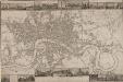
LANGLEY & BELCHE'S NEW MAP OF LONDON
Proof before letters is the term for an impression of a print withdrawn before the title is added to the image prior to publication. This is a proof before letters copy of Langley & Belche's 1812, with illustrated views of prominent London buildings (including the newly opened docks) along the top and bottom of the plate. The plan is divided into lettered squares for reference. It was originally accompanied by Langley & Belch's street directory or 'Companion to their new map of London'. Langley, Edward & Belch, William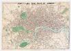
Whitbread's new plan of London
1 : 21500 Whitbread, J J. Whitbread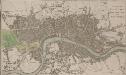
A PLAN OF LONDON WESTMINSTER AND SOUTHWARK
The title of this small map of London appears at top right, with publisher's imprint below the map. The river, city boundaries and open spaces are distinguished by colour use. Phillips, Richard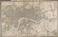
CROSS'S NEW PLAN OF LONDON 1828
The title of this folding map is inset in the top border, with the publisher's imprint and explanatory notes in the bottom border and a list of parishes in a table at top right. The map is divided into half-mile squares for reference, with the river, open spaces and the boundaries of London, Westminster and Southwark highlighted in different colours. Cross, Joseph
A New Map of LONDON and its ENVIRONS From an Original Survey
This London Map comprises two sheets, with title at top right, imprint below the title, compass star at middle right and the scale bar at bottom left. Set within a decorative border, the map extends beyond the built-up area of the city to include parts of Middlesex, Surrey, the Lea River Valley and Greenwich. Thompson, George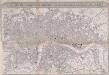
IMPROVED MAP OF LONDON for 1834, from AN ACTUAL SURVEY
The title of this map appears in a panel above the plan, with a scale bar inset in the bottom border. The map extends westward to include Chelsea Beach and shows the proposed tunnel under the Thames at Wapping. The Greenwich-to-London railway line also features. Under construction at the time of this survey, the line reached Bermondsey from Greenwich in 1836. Ten months later the line reached London Bridge, making it the first railway terminus in the capital.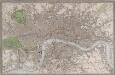
NEW PLAN OF LONDON, WESTMINSTER AND SOUTHWARK
This is a later edition of the map of London, Westminster and Southwark first issued by Gardner in 1827. The map is enclosed in a border and features title along the top, key and scale bar along the bottom, with borough boundaries, open spaces and water courses and main roads in colour. Additions to earlier editions of the map include the Great Western, London and Birmingham, Eastern Counties, Blackwall and Croydon railways. Gardner, James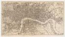
Reynolds's map of London : with the latest improvements
1 : 16000 Martin, Henry, fl. 1830-1852 J. Reynolds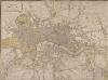
LAURIE and WHITTLE NEW MAP OF LONDON WITH ITS ENVIRONS &C. Including the Recent Improvements
The title of this map of London and suburbs appears at top left, with the key to symbols and abbreviations at the top right and a compass rose at the bottom centre. The map is divided into mile squares with borders marked off in furlongs for reference. Squares, open spaces and city boundaries are distinguished in colour. This is a later edition of a map first issued in 1804, updated to include the new bridges and the approaches at Waterloo and Vauxhall (indicated by dotted lines). Built between 1809 and 1819, Vauxhall, Waterloo and Southwark bridges were projected, funded and constructed by private commercial companies hoping to profit from toll-paying traffic from Lambeth, Camberwell and the rest of south London. Laurie, Robert and Whittle, James
The London guide, or, a pocket plan of the cities of London & Westminster & borough of Southwak : with the new buildings &c. to the year 1767
Ellis, J. (John), fl. 1750-1800 Printed for Carington Bowles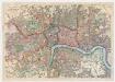
Bacon's map of London : with railways in operation and constructing corrected to date
Bacon & Co Bacon & Co.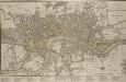
A NEW PLAN OF LONDON, WESTMINSTER AND SOUTHWARK 185
The title of this map appears at top right, with a compass rose and scale bar at bottom right. Below the plan is a list of public offices, with a special section dedicated to those at Somerset House. Designed by William Chambers, Somerset House was built in stages between 1771 and 1835, the first large block ever built to accommodate government offices. Over the years it has housed the Royal Navy, the Stamp Office, Hackney Coaches and Barge Master, the General Register of Births, Deaths and Marriages and the Inland Revenue. Laurie, Robert and Whittle, James