Maps of Mediterranean Sea
Mare Mediterranevm
1 Karte : Kupferdruck ; 37 x 59 cm Hauer Homännische Erben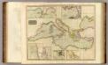
Mediterranean Sea.
1 : 6300000 Thomson, John
La mer Mediterranée divisée en ses principales parties ou mers
1 : 6200000 Středozemní moře-oblast Valk, Gerhard G. Valk
Nord de l'Afrique, Mer Mediterranee, Europe Meridionale.
1 : 9300000 Brue, Adrien Hubert, 1786-1832
Carte des pays qu'occupe maintenant la mer Mediterranée
1 Karte : Kupferdruck ; 32 x 66 cm La Borde s.n.
Mittelmeerländer
1 : 4000000 Afrika severní Georg Westermann
Mittelmeerländer
1 : 4000000 Afrika severní Georg Westermann
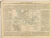
Europa Aetate Napoleontis I
Europa Napoleon I., Frankreich, Kaiser
La mer Mediterranée
1 Karte auf 2 Blatt : Kupferdruck ; 53 x 86 cm Sanson; Jaillot chez H. Iaillot joignant les grands Augustins aux 2 Globes
La mer Mediterranée
1 Karte auf 2 Blatt : Kupferdruck ; 47 x 85 cm Valck par G. Valck sur le Dam
Carte geographique representant la mer Mediterranée ou la seconde partie du théatre de la guerre entre les Russes et les Turcs
1 Karte auf 3 Blättern : Kupferdruck ; 53 x 130 cm Lotter Tobias Konrad Lotter
101. Mediterranean Sea. The World Atlas.
1 : 10000000 USSR (Union of Soviet Socialist Republics).
Mapa de la Conca Mediterrània: principals infrastructures de transport : regions europees riberenques de la Mediterrània
1 : 3500000 1 Mapa. Institut Cartogràfic de Catalunya ICC
(Mediterranean Region)
1 : 10900000 Bowen, Frances
L'Hellénisme dans l'Antiquité [I]
Makedonien Hellenismus Altertum Kümmerly & Frey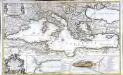
La mer Mediterranée
1 Karte auf 2 Blättern : Kupferdruck ; 53 x 87 cm Sanson; Denis; Basset; Basset chès Basset rue St. Jacques au coin de celle des Mathurins à l'Image S.e Genevieve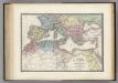
Nord de l'Afrique, Mediterranee.
1 : 9200000 Levasseur, E.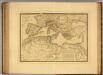
Nord de l'Afrique, Mer Mediterranee, Europe Meridionale.
1 : 9300000 Picquet, C.
Mare Mediterraneum
1 Karte : Kupferdruck ; 48 x 56 cm Seutter Matthäus Seutter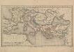
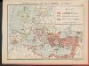
Europa und das oström. Reich zur Zeit der Kreuzzüge
Europa, Byzantinisches Reich, Kreuzzüge
Mer Mediterranee.
1 : 10000000 Garnier, F. A., 1803-1863
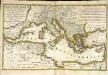
Das Römische Reich unter Traianus
starověký Řím
Říše římská ve své největší rozsáhlosti
Tableau historique de Rome ancienne.
1 : 23700000 Duval, Henri
[Das Mittellaendische und Schwarze Meer, Auch als General Karte des Osmanischen Reichs]
Hand-Atlas über alle Theile der Erde nach dem neuesten Zustande und über das Weltgebäude Stieler, Adolf bei Justus Perthes
Karte des Mittelländischen Meeres
Středozemní moře-oblast Handtke, Friedrich C. Flemming
Aelteste Geographie der Griechen, nach dem Homer und Hesiodus
Afrika severní
Mediterranean, Black Sea cables, wireless stations.
1 : 13000000 Philip, George