Maps of Denmark
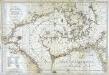
Carte de la mer de Dannemark et des entrées dans la mer baltique
1 Karte : Kupferdruck ; 59 x 85 cm s.n.
Denmark.
1 : 1800000 Mitchell, Samuel Augustus
Denmark, pt. of Norway.
1 : 1770000 Society for the Diffusion of Useful Knowledge (Great Britain)
Denmark, S. Norway.
1 : 1774080 Letts, Son & Co.
Denmark.
1 : 1837440 Tallis, J. & F.
Denmark and part of Norway (Denmark, Norge)
1 : 2000000 Dánsko Walker, C. Baldwin & Cradock
Denmark.
1 : 2400000 Bowen, Emanuel
Denmark.
1 : 1250000 Teesdale, Henry
Denmark.
1 : 1500000 Colton, G.W.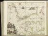
[124][127] Daniae, Frisiae, Groningae et Orientalis Frisiae littora, uit: Atlas sive Descriptio terrarum orbis
Annotatie: Gedigitaliseerde versie. Amsterdam. Heiloo : Picturae (vervaardiger), 2015. tiff-bestand. Gedigitaliseerd: 07-01-2015; Origineel: Universiteitsbibliotheek Vrije Universiteit (XL.05127.-) ; Netherlands; Titelpagina ontbreekt Wit, Frederik de Amsterdam : Frederick de Wit
Denmark.
1 : 1500000 Colton, G.W.
Dänemark mit Schleswig, Holstein
Dánsko
[Dänemark, Island, die Far-Oer]
Plastischer Schul-Atlas über alle Theile der Erde : in 24 Karten Woldermann, G Verlag von P. Eckerlein
[Daenemark mit Schleswig, Holstein und Lauenburg auch Südl. Theil v. Schweden]
Hand-Atlas über alle Theile der Erde nach dem neuesten Zustande und über das Weltgebäude Stieler, Adolf bei Justus Perthes
Atlas für Handel und Industrie: Für Kaufleute, Fabrikante u. Gewerbetreibende, Handlungs- u. Gewerbe-Schulen

Charte von Daenemark
Dánsko
CHARTE von DAENEMARK
1 : 1280000 Bornholm (Dánsko)
Charte von Daenemark
1 : 1280000 Bornholm (Dánsko)
Daenemark
E. von Sydow's Schul-Atlas in sechs und dreissig Karten Sydow, Emil von bei Justus Perthes
Daenemark mit Holstein und Lauenburg auch südlicher Theil von Schweden
1 : 3200000 Dánsko
Denmark.
1 : 1393920 Colton, G.W.
[Königreich Daenemark]
Neuester Schul-Atlas Walch, Johann im Verlag bei Joh. Walch
Denmark.
1 : 1800000 Tanner, Henry S.
Magna Britannia complectens Angliae, Scotiae et Hiberniae regn. in suas prov. et comitat.
Velká Británie Seutter, Matthäus Vilém Oranžský per Homannum
Denmark, Sleswig, Holstein.
1 : 823680 Stanford, Edward
Daenemark
Allgemeiner Atlas [Walch, Johannes] im Verlag bei Johannes Walch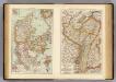
Denmark, Alsace-Lorraine, Palatinate.
1 : 1500000 Andree, Richard; Times (London, England)
Daenemark mit Schleswig, Holstein und Lauenburg auch Südl. Theil v. Schweden
Hand-Atlas über alle Theile der Erde nach dem neuesten Zustande und über das Weltgebäude Stieler, Adolf bei Justus Perthes
Denmark.
1 : 1800000 Mitchell, Samuel Augustus


