Maps of Sahara

Carte mar.ne d'une partie de l'Europe, de l'Asie et de l'Afrique
1 Karte : Kupferdruck ; 41 x 49 cm Königliche Akademie der Wissenschaften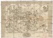
Universal-Historie auf der Land-Karten
Afrika severní Ehmann, Andreas
Monde connu des Grecs avant Alexandre.
1 : 22000000 Vivien de Saint-Martin, M.
Ptolemeisch general Tafel
1 : 65000000 1 Karte : Holzschnitt ; 31 x 36 cm Ptolemaeus, Claudius [Sebastian Münster]
Historische Weltkarte
Afrika severní Pařízek, Aleš Vincenc Niederhofer, Ondřej
Historische Weltkarte
Afrika severní Pařízek, Aleš Vincenc Niederhofer, Ondřej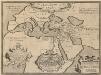
Geographia Sacra. [Karte] [Welt] [Nebenkarte], in: Theatrum orbis terrarum, S. 432.
1 Karte aus Atlas Ortelius, Abraham Vrients, Jan Baptista
Orbis terrarum verteribus notus usque ad annum 500 a. Chr.
Alte Welt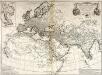
Orbis veteribus notus
1 Karte : Kupferdruck ; 49 x 66 cm Anville; Santini apud Franciscum Santini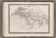
Monde Connu des Anciens.
1 : 34000000 Monin, C.V.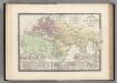
Monde Connu des Anciens.
Levasseur, E.
Terra Veteribus Nota.
1 : 47000000 Finley, Anthony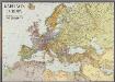
Karte von Europa
1 : 7500000 Berlin [etc.] : Ullstein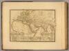
Monde connu des anciens.
1 : 25000000 Picquet, C.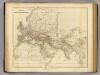
Orbis Veteribus Notus.
1 : 24000000 Arrowsmith, John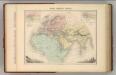
Monde Connu Des Anciens.
1 : 32740000 Migeon, J.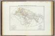
Carta generale del mondo conosciuto dagli antichi.
1 : 26000000 Marzolla, Benedetto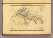
Monde Connu des Anciens.
1 : 47000000 Malte-Brun, Conrad, 1775-1826
World known to ancients.
1 : 50000000 Mitchell, Samuel Augustus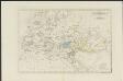
[Historisch-geographischer Atlas zu den allgemeinen Geschichtswerken von C. v. Rotteck, Pölitz u. Becker] : Übersichtskarte für die Geschichte der ältesten Zeit bis auf Cyrus
von Julius Loewenberg Lithographie von B. Herder in Freiburg im Breisgau [Freiburg im Breisgau] : [Herder]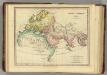
Terra Veteribus, Nota. (1826)
1 : 46000000 Tanner, Henry S.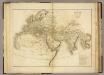
The World as known to the Ancients.
1 : 23000000 Playfair, Principal
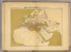
Asia Antiqua.
1 : 64000000 Fenner, Rest.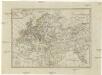
Geographie des Mittel Alters
1 : 36360000 Afrika severní
Europa zur Zeit Karls des Grossen
Europa Karl I., Heiliges Römisches Reich, Kaiser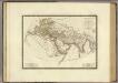
Monde connu des anciens.
1 : 25000000 Brue, Adrien Hubert, 1786-1832
Empire de la Porte ottomane en Europe, en Asie et en Afrique avec les pays qui lui sont tributaires
1 : 9000000 Lotter Family (Augsburg, Germany) Frères Lotter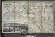
The Turkish Empire in Europe, Asia and Africa, divided into all its governments, together with the other territories that are tributary to it, as also the dominions of ye Emperor of Marocco.
from The world described, or, A new and correct sett of maps : shewing the kingdoms and states in all the known parts of the earth, with the principal cities, and most considerable towns in the world ... / ... by Herman Moll, geographer ...


