Maps of Angola

Cimbebas et Caffariæ littora a Catenbela ad promontorium Bonæ Spei
1 Karte : Kupferdruck ; 41 x 53 cm Renard by L. Renard
[137][140] Cimbebas et Caffariae Littora a Catenbela ad promontorium Bonae Spei ..., uit: Atlas sive Descriptio terrarum orbis
Annotatie: Gedigitaliseerde versie. Amsterdam. Heiloo : Picturae (vervaardiger), 2015. tiff-bestand. Gedigitaliseerd: 07-01-2015; Origineel: Universiteitsbibliotheek Vrije Universiteit (XL.05127.-) ; Netherlands; Titelpagina ontbreekt Wit, Frederik de Amsterdam : Frederick de Wit
Pascaart van de zee-custen van Angola, en Cimbebas van Rivier de Galion tot C. de Bona Esperanca
1 Karte : Kupferdruck ; 42 x 54 cm Doncker by Hendrick Doncker boeckverkoper inde Nieuwebrug-steeg in 't Stuiermans gereetschap
St. Helena, this island belongs to ye English east India Company whose ships usually touch here for a recruit of fresh water and provisions ... ; The bay of Agao de Saldanha, this bay is 70 miles north of ye Cape of Good Hope ...
1 : 1
Charte von Nieder Guinea
Angola
CHARTE von NIEDER GUINEA
Angola
Spezial - karte von AfricaSektion Capland (9)
1 : 4000000 1 full d'1 mapa en 10 fulls i estoig Hermann Habenicht; Justus Perthes
Spezial-Karte von Afrika
1 : 4000000 Blatt 9 Habenicht, Hermann Perthes
Nieder Guinea, W. Mittel-Africa.
1 : 5500000 Weiland, C. F. (Carl Ferdinand), d. 1847
Deutsch-Südwest-Afrika
1 : 3000000 Kiepert, Richard ; Sprigade, Paul Geographische Verlagshandlung Dietrich Reimer
Carta do Sul de Angola compreendendo a regiao situada ao sul do paralello 14\00BA
1 : 500000 Angola Ministerio das Colonias, Comissao de Cartografia
Deutsch-Südwestafrika
1 : 2000000 Namibie Sprigade, Paul Fischer, R. Dietrich Reimer (Ernst Vohsen)
Gross-Namaqua-Land und das Gebiet des Hauses F.A. Lüderitz
1 : 1750000 Durynsko (Německo) Hassenstein, Bruno Hahn, Th. Justus Perthes
Deutsche Kolonien
1 : 12000000 Kamerun Meyer, Joseph Bibliographisches Institut
Union of South Africa Special Map Accompanying Richmond's South African All Mining Year Book (Sheet 1)
Union of South Africa. Special map accompanying Richmond's South African All Mining Year Book illustrating the location of Mines, Quarries and Works. Johannesburg : Hortors
Cape Province, Transvaal, &c. - western section.
1 : 2500000 John Bartholomew and Son
Carta de Angola
1 : 2000000 Wall Map Junta de Investigações do Ultramar Governo Geral de Angola
Colony of Good Hope.
1 : 9500000 Fenner, Rest.
Congo et Angola. Afrique 41.
1 : 1641836 Vandermaelen, Philippe, 1795-1869
Benguela. Afrique 44.
1 : 1641836 Vandermaelen, Philippe, 1795-1869
Cote Deserte. Afrique 48.
1 : 1641836 Vandermaelen, Philippe, 1795-1869
Partie, Pays des Hottentots. Afrique 50.
1 : 1641836 Vandermaelen, Philippe, 1795-1869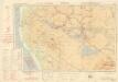
Ondangua

Carte internationale du monde au 1,000,000 E
1 : 1000000 Windhoek (Namibie) Surveyor generals office S.W. Africa
Provincia de Angola Porto do Ambriz à Baía dos Elefantes
1 : 750000 Hydrographic Map Instituto Hidrográfico Portugal Instituto Hidrográfico Portugal
Cap de Bonne Esperance. Afrique 53.
1 : 1641836 Vandermaelen, Philippe, 1795-1869
Matamba. Afrique 42.
1 : 1641836 Vandermaelen, Philippe, 1795-1869
International map 1:1,000,000
1 : 1000000 Jihoafrická republika Geographical Section, General Staff
No title


