Maps of Oklahoma

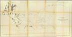
Western territories. sheet no. 2
1 : 2000000 Gillespie, George Lewis 18..-....; États-Unis. Corps of Engineers [Washington, D.C.] : Office of the Chief of Engineers, U.S. Army
[Die Vereinigten Staaten von Nord-Amerika, Blatt 5]
Handatlas über alle Theile der Erde und über das Weltgebäude Stieler, Adolf Justus Perthes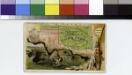
Indian Territory [Oklahoma].
From [Series of advertising cards issued by Arbuckle Bros. Coffee Company, each consisting of a map of a United States state or territory with related illustrations.]
Nebraska and Kansas.
1 : 3850000 Colton, J. H.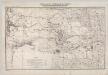
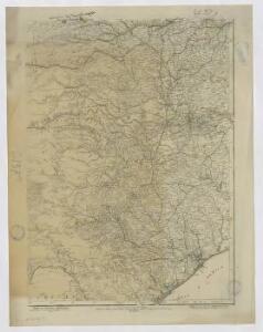
Indian Territory With Parts Of Neighboring States And Territories.
1 : 1200000 Jackson, Henry
State of Texas.
1 : 4300000 Texas Land and Immigration Company
Texas.
1 : 3651000 Fisher, Richard Swainson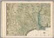
A Map of the British Empire in America. (Sheet 9).
1 : 2000000 Popple, Henry
Texas.
1 : 1330560 Cram Atlas Company
Indian Territories.
1 : 2000000 Colton, G.W.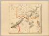
Partie des Etats-Unis. Amer. Sep. 55.
1 : 1641836 Vandermaelen, Philippe, 1795-1869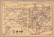
Oklahoma.
1 : 1950000 Rand McNally and Company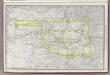
Indian Territory. (Oklahoma).
1 : 2000000 Rand McNally and Company
J. De Cordova's Map Of The State Of Texas.
1 : 1180000 G.W. & C.B. Colton & Co.
J. De Cordova's Map Of The State Of Texas.
1 : 1180000 De Cordova, Jacob
Arkansas Ter.
1 : 3801600 Lucas, Fielding Jr.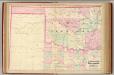
Indian Terr., Texas NW portion.
1 : 1267200 Asher & Adams
Indian Territory and Texas, North West Portion.
1 : 1300000 Asher & Adams
Eastern Texas.
1 : 1530000 Rand McNally and Company
Indian. Ty.
1 : 1330560 Cram Atlas Company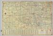
Shell Highway Map of Oklahoma.
1 : 1267200 Shell Oil Company
Shell Highway Map of Texas (eastern portion).
1 : 1647360 Shell Oil Company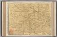
Oklahoma.
1 : 824000 Rand McNally and Company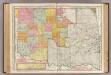
Oklahoma and Indian Territory.
1 : 824000 Rand McNally and Company
Special -Karte der Vereinigten Staaten von Nord - America No 9.

Texas (Eastern Section).
1 : 1331000 Rand McNally and Company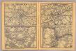
St. Louis, New Orleans, Dallas Ft. Worth, Portland.
Rand McNally and Company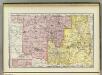
Indian Territory, Oklahoma.
1 : 1300000 Rand McNally and Company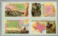
Indian Territory, New Mexico, South Dakota, Texas.
Arbuckle Bros.