Maps of Halvesbostel

Meßtischblatt 1210 : Everstorf, 1899
1 : 250000 Everstorf. - Aufn. 1897, hrsg. 1899. - 1:25000. - [Berlin]: Reichsamt für Landesaufnahme, 1899. - 1 Kt.
Composite: 177. Buxtehude. (Germany)
1 : 100000 Reichsamt fur Landesaufnahme
177. Buxtehude. (Germany)
1 : 100000 Reichsamt fur Landesaufnahme
A General Prospect of the Royall House and Garding at Hernhausen
Mollova mapová sbírka Müller, Johann Jacob Sassen, Joost van Schenk, Peter I
178. Harburg. (Germany)
1 : 100000 Reichsamt fur Landesaufnahme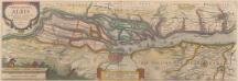
Nobilis Fluvius Albis maximâ curâ, ex variis famosisque Autoribus collectus, et in lucem editus. [Karte, Teil 1], in: Novus atlas absolutissimus, Bd. 2, S. 33.
1 Karte aus Atlas Janssonius Offizin
57. Harburg, uit: Topographische Uebersichtskarte des Deutschen Reiches / herausgegeben v. d. Kartogr. Abt. d. Königl. Preuß. Landesaufnahme
1 : 200000 titelvariant: Topogr. Übersichtskarte des Deutschen Reiches; Annotatie: Titel boven bladen ook: Topogr. Übersichtskarte des Deutschen Reiches; Annotatie geografische gegevens: Op elk blad twee maatstokken: 10 Kilometer = 5,5 cm; 1 geogr. Meile = 3,6 cm; Legenda onder op elk blad Königlich Preußische Landesaufnahme. Kartographische Abtheilung [S.l : Königlich Preußische Landesaufnahme, Kartographische Abtheilung]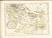

STORMARIA | DVCATVS
Auctore Joh: Meyer Husumensi. Matthias & Nicolaus Peters | Goldtschmide gebr. Hus. sculp. [Amsterdam : Joan Blaeu]
Dvcatvs Bremae et Princ. Verdae
1 : 200000 Mollova mapová sbírka
Lüneburg 45, uit: [W. Liebenow's Special-Karte von Mittel-Europa]
1 : 300000 titelvariant: W. Liebenow's Mittel-Europa; Annotatie: Titel boven de bladen: W. Liebenow's Mittel-Europa Johannes Wilhelm Liebenow 1822-1897 Hannover : Hermann Oppermann
Tabula Geographica novissima Ducatus Stormariae, in Meridionali parte Holsatiae. [Karte], in: Novus atlas absolutissimus, Bd. 1, S. 152.
1 Karte aus Atlas Janssonius Offizin
Le Theatre de Bellone :
Mollova mapová sbírka Schenk, Pieter Braakman, Adriaan
Carte topographique d'Allemagne
1 : 225000 Brémy (Německo) Jaeger, Johann Wilhelm Abraham Berndt, Johann Christoph I.W.A. Iaeger
Paskaart vande Iade, Weser en Elve :
1 : 250000 Mollova mapová sbírka Keulen, Johannes van Keulen, Johannes van

Das Hertzogthum Bremen nebst dem Stifft oder Fürstenthum Verden im Nieder Sächsischen Creiss
1 : 750000 Mollova mapová sbírka Weigel, Johann Christoph Weigel, Johann Christoph

Le Duché de Bremen et Ferden
1 : 370000 Mollova mapová sbírka Le Rouge, Georges-Louis Le Rouge, Georges-Louis
Ducatus Bremae & Ferdae maximaeque partis fluminis Visurgis descriptio
1 : 320000 per Fredericum de Witt Amstelodami uytgegeven door Reinier & Josua Ottens, voor aen op den Nieuwendyck in de Warelt [Amsterdam] : ex officina R. & J. Ottens

Ducatus olim episcopatus Bremensis et ostiorum Albis et Visurgis fluviorum, novissima descriptio
1 : 308000 Brémy (Německo : spolková země) Graaf, Cornelius de Ioannes Ianßonius
Holsatiae Tabula Generalis in qua sunt Ducatus Holsatiae Ditmarsiae Stormariae et Wagriae
1 : 310000 Mollova mapová sbírka Schenk, Pieter Schenk, Peter I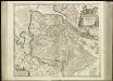
[46][46] Ducatus Bremae & Ferdae ..., uit: Atlas sive Descriptio terrarum orbis
Annotatie: Gedigitaliseerde versie. Amsterdam. Heiloo : Picturae (vervaardiger), 2015. tiff-bestand. Gedigitaliseerd: 07-01-2015; Origineel: Universiteitsbibliotheek Vrije Universiteit (XL.05127.-) ; Netherlands; Titelpagina ontbreekt Wit, Frederik de Amsterdam : Frederick de Wit

DUCATUS BREMAE et FERDAE, Maximaeque partis DUCATUS STORMARIAE, COMITATUS OLDENBURGI, ALBIS, VISURGISQUE FLUMINUM Novissima Descriptio
1 : 330000 Labe-oblast (Česko a Německo) Visscher, Nicolaus per Nicolaum Visscher
Ducatus Bremae et Ferdae nova tabula
1 : 370000 Brémy (Německo : spolková země) Homann, Johann Baptist â Ioh. Bapt. Homanno
Ducatus Bremae et Ferdae nova tabula
1 : 370000 Brémy (Německo : spolková země) Homann, Johann Baptist â Ioh. Bapt. Homanno
Holsatiae Dithmarsiae Stormariae et Vagriae Dvcatvs
1 : 480000 Mollova mapová sbírka Weigel, Christoph Kauffer, Michael Weigel, Christoph I.