Maps of gmina Bestwina

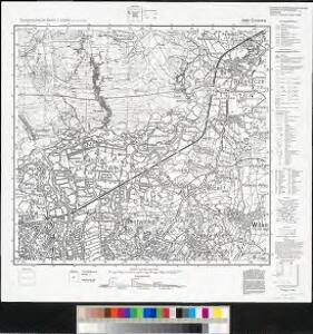
Meßtischblatt 6080 : Grzawa, 1934
1 : 250000 Grzawa. - Aufn. 1881, hrsg. 1883, letzte Nachtr. 1934. - 1:25000. - [Berlin]: Reichsamt für Landesaufnahme, 1934. - 1 Kt.
Stabilní katastr - Pracovní otisk - Brzeszcze in Galizien V
1 : 2880
Stabilní katastr - Pracovní otisk - Brzeszcze in Galizien VIII
1 : 2880

Stabilní katastr - Pracovní otisk - Brzeszcze in Galizien přehledka
1 : 28800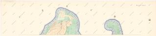
Stabilní katastr - Pracovní otisk - Brzeszcze in Galizien III
1 : 2880
Bielitz und Biala.
from Spezialkarte der osterreichisch-ungarischen Monarchie.
Bielitz und Biała
1 : 75000 Bielsko-Biała-oblast (Polsko) Bloschitz, R. K. u. k. Militärgeographisches Institut
Bielitz und Biała
1 : 75000 Bielsko-Biała (Polsko : oblast) Otawa K. u. k. militär-geographisches Institut
Bielitz und Biała
1 : 75000 Bielsko-Biała (Polsko : oblast) Otawa K. u. k. Militärgeographisches Institut
157. Pless, uit: Topographische Uebersichtskarte des Deutschen Reiches / herausgegeben v. d. Kartogr. Abt. d. Königl. Preuß. Landesaufnahme
1 : 200000 titelvariant: Topogr. Übersichtskarte des Deutschen Reiches; Annotatie: Titel boven bladen ook: Topogr. Übersichtskarte des Deutschen Reiches; Annotatie geografische gegevens: Op elk blad twee maatstokken: 10 Kilometer = 5,5 cm; 1 geogr. Meile = 3,6 cm; Legenda onder op elk blad Königlich Preußische Landesaufnahme. Kartographische Abtheilung [S.l : Königlich Preußische Landesaufnahme, Kartographische Abtheilung]
Utilisation de chemins de fer pour le transport des marchandises vers Tchécoslovaquie Pologne
Polsko Čs. voj. zeměpis. ústav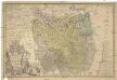
Principatvs Silesiae Teschinensis nova et accurata delineatio
1 : 130000 Těšínské Slezsko Wieland, Johann Wolfgang ab Homannianis Heredibus
Principatvs Silesiae Teschinensis nova et accurata delineatio distincte insimul exhibens
1 : 125000 Těšínské Slezsko Wieland, Johann Wolfgang Homannianos Heredes
Auschwitz u. Sator
1 : 2000000 Herzogtum Auschwitz
Principatvs Silesiae Teschinensis
1 : 115000 Těšínské Slezsko Homannianis Heredibus
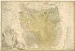
DVCATVS | OSWIECZENSIS, | et | ZATORIENSIS.
[Amsterdam : Joan Blaeu]
Teschinensis

Sbírka map a diagramů použitých na mírových konferencích v Paříži v letech 1919 - 1920

Nova et accurata geographica delineatio Ducatus Teschenensis...

Nova et accurata geographica delineatio Ducatus Teschenensis...

Teschner Kreis

Ducatus Oswieczensis, Et Zatoriensis, Descriptio. [Karte], in: Theatrum orbis terrarum, S. 375.
1 Karte aus Atlas Ortelius, Abraham Vrients, Jan Baptista
Ducatus Oswieczensis, Et Zatoriensis, Descriptio. [Karte], in: Theatrum orbis terrarum, S. 280.
1 Karte aus Atlas Ortelius, Abraham
Sbírka map a diagramů použitých na mírových konferencích v Paříži v letech 1919 - 1920

Těšínsko