Maps of Bühlertal

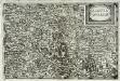
Meßtischblatt [7314] : Bühl, 1875
1 : 250000 Bühl. - 1:25000. - Leipzig: Giesecke & Devrient, 1875. - 1 Kt.
Le Flambeau de la Guerre Allumee au Rhin
Mollova mapová sbírka Delisle, Guillaume Schenk, Peter II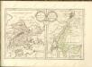

Geologische Karte der Umgebungen von Baden
1 : 50000 Südblatt Sandberger, Fr. Chr. Fr. Müller'sche Hofbuchhandlung
Blatt 14. Freystett, uit: Topographische Karte des Rheinstromes und seiner beiderseitigen Ufer von Hueningen bis Lauterburg oder längs der Französich-Badischen Gränze, ... / ... reducirt und gezeichnet ... im Bureau der Grossherzoglich Badischen Rheingränz-Berichtigungs Commission
1 : 20000 titelvariant: Rheingränz-Carte; Annotatie: Voor aanwezige bladen zie overzichtsblad Grossherzogliche Badische Rheingränz-Berichtigungs Commission. Bureau Freiburg im Breisgau : im Herder'schen Künst-Institut
Carte über den Lauf des Rheins von Basel bis Lauterburg längs der Badisch - Französischen Grenze

Chorographia Argentorati Alsatiae Metropolis
1 : 85000 Mollova mapová sbírka Seutter, Matthäus Seutter, Matthäus
Argentorati Territorium, vulgo Strasburger Gebiet Cum Maxima Episcopatus Cognominis, ac Occidentaliori Badensis Marchionatus Parte &c.
1 : 120000 Mollova mapová sbírka Allard, Carel Allard, Carel
Territorium Argentoratense
1 : 130000 Mollova mapová sbírka Valk, Gerhard Schenk, Pieter Schenk, Peter I
Territorium Argentoratense
1 : 130000 Mollova mapová sbírka Janssonius, Johannes Keere, Pieter van den Janssonius, Johannes I
Chorographia Argentorati Alsatiæ metropolis
1 Karte : Kupferdruck ; 47 x 56 cm Seutter Matthäus Seutter
Argentorati territorium, vulgo Strasburger Gebiet
1 Karte : Kupferdruck ; 46 x 57 cm Allard by I. Cóvens et C. Mortier
169. Strassburg i. Elsass, uit: Topographische Uebersichtskarte des Deutschen Reiches / herausgegeben v. d. Kartogr. Abt. d. Königl. Preuß. Landesaufnahme
1 : 200000 titelvariant: Topogr. Übersichtskarte des Deutschen Reiches; Annotatie: Titel boven bladen ook: Topogr. Übersichtskarte des Deutschen Reiches; Annotatie geografische gegevens: Op elk blad twee maatstokken: 10 Kilometer = 5,5 cm; 1 geogr. Meile = 3,6 cm; Legenda onder op elk blad Königlich Preußische Landesaufnahme. Kartographische Abtheilung [S.l : Königlich Preußische Landesaufnahme, Kartographische Abtheilung]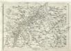
Geographica Provinciarum Sveviae Descriptio =
Mollova mapová sbírka Hurter, Johann Christoph Bodenehr, Johann Georg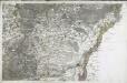
[Strasbourg]
1 Blatt : 60 x 92 cm s.n.
Argentoratensis Agri Descriptio. [Karte], in: Theatrum orbis terrarum, S. 175.
1 Karte aus Atlas Ortelius, Abraham
Argentoratensis Agri Descriptio. [Karte], in: Theatrum orbis terrarum, S. 267.
1 Karte aus Atlas Ortelius, Abraham Vrients, Jan Baptista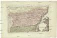
Der District Hagenau
1 : 182000 Haguenau (Francie)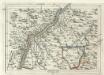
Geographica Provinciarum Sveviae Descriptio =
Mollova mapová sbírka Hurter, Johann Christoph Bodenehr, Gabriel
Territorium Argentoratense
1 Karte : Kupferdruck ; 36 x 48 cm Janssonius van Waesbergen; Pitt; Swart apud Janssonio-Waesbergios Mosem Pitt et Stephanum Swart
Territorium Argentoratense
1 Karte : Kupferdruck ; 36 x 48 cm Janssonius; Keere Ioannes Ianssonius excudit
Territorium Argentoriatense. [Karte], in: Novus atlas absolutissimus, Bd. 2, S. 208.
1 Karte aus Atlas Janssonius Offizin
Territorium Argentoratense / apud Janssonio-Waesbergios, Mosem Pitt et Stephanum Swart
1 : 103000 Annotatie: Origineel is Blad 114 in atlas factice; Kaart toont het gebied rondom Straatsburg, deels gelegen in de Elzas en deels in Baden-Württemberg; In rechter bovenhoek: XLIV; Met wapens; Annotatie geografische gegevens: Schaalstok op de kaart: Milliaria Germanica communia; Oost boven Johannes Janssonius van Waesberge -1681?; Moses Pitt ca. 1654-1696; Stephanus Swart [Oxford : printed at the Theatre at Oxford]
[Carte eines Theils des Schwartzwaldes]

Suevia Universa :
1 : 170000 Mollova mapová sbírka Michal, Jacques de Seutter, Matthäus Seutter, Matthäus
Alsatia inferior
1 Karte : Kupferdruck ; 14 x 22 cm Lambert Andreae
Charte von der Grafschaft Hanau-Lichtenberg
1 : 180000 Grattenauer, Ernst C. Grattenauer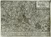
Alsatia inferior
1 Karte : Kupferdruck ; 17 x 27 cm Specklin; Quad Johannes Bussemacher
![Meßtischblatt [7314] : Bühl, 1875](https://images-2.georeferencer.com/images/iiif/600975862938/full/,300/0/native.jpg)

