Maps of Scandinavia
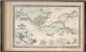
The Baltic Sea.
Mitchell, Samuel Augustus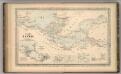
The Baltic Sea.
Mitchell, Samuel Augustus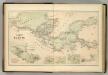
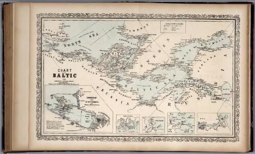
Chart of the Baltic.
Hughes, William
The countries of northern Europe

Schweden. Größte Machtentfaltung (1658)
1 : 18000000 Ostseeraum, Schweden, Expansion
Neueste Karte von Schweden und Norwegen
Grosser Hand-Atlas über alle Theile der Erde in 170 Karten Meyer, J. Verlag des Bibliographischen Instituts
[Einwanderung in Reval 1639-1710)
Reval Einwanderung Essen, Nicolai v. ; Eichhorn, Nicolai
Länder der Nord- und Ostsee
1 : 10000000 Nordeuropa
[Schweden und Norwegen oder Scandinavische Halbinsel Königreich Daenemark]
Geographischer Atlas über alle Theile der Erde Ziegler, Jakob Melchior Verlag von Dietrich Reimer
Schweden. Größte Machtentfaltung (1658)
1 : 15000000 Ostseeraum, Schweden
Karte der beiden Königreiche Schweden u. Norwegen
Neuester Schul-Atlas Walch, Johann im Verlag bei Joh. Walch
Nordeuropa 1871
Nordeuropa Kunz, Andreas ; Röss, Wolf ; Johnen, Bettina ; Moeschl, Joachim Robert
[Scandinavien und Dänemark]
[Allgemeiner Atlas über alle Theile der Erde in 29 Blättern] Ziegler, Jakob Melchior Top. Anstalt v. J. Wurster u. Comp.
Kaart van de Oost-Zee met hare golven, baaijen, eilanden, rotsen, klippen, diepten, enz. enz. benevens den platten grond op groote schaal van de voornaamste zee-plaatsen krijgs- en handelhavens
1 : 2584000 uit de naauwkeurigste bronnen geput en uit de beste zee- en landkaarten opgemaakt door A.J. Bogaerts lithograaph Breda : Bogaerts
Nordeuropa 1905
Nordeuropa Kunz, Andreas ; Röss, Wolf ; Johnen, Bettina ; Moeschl, Joachim Robert
Hollande et Belgique, Suede et Danemark.
Andriveau-Goujon, J.
Nordeuropa 1914
Nordeuropa Kunz, Andreas ; Röss, Wolf ; Johnen, Bettina ; Moeschl, Joachim Robert
[Einwanderung in Reval 1710-1786)
Reval Einwanderung Gebauer, Victor
Nordeuropa 1815
Nordeuropa Kunz, Andreas ; Treiling, Thomas
Nordeuropa 1809
Nordeuropa Kunz, Andreas ; Treiling, Thomas
Nordeuropa 1922
Nordeuropa Kunz, Andreas ; Treiling, Thomas
Tabula exactissima Regnorum Sueciae et Norvegiae, nec non Maris Universi Orientalis [...] [Karte], in: Novus atlas absolutissimus, Bd. 1, S. 45.
1 Karte aus Atlas Janssonius Offizin
Nordeuropa 1865
Nordeuropa Kunz, Andreas ; Röss, Wolf ; Johnen, Bettina ; Moeschl, Joachim Robert
Nordeuropa 1937
Nordeuropa Kunz, Andreas ; Treiling, Thomas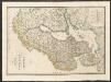
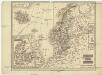
Sweden and Norway
A new general atlas of modern geography, consisting of a complete collection of maps of the four quarters of the globe Wyld, James James Wyld
Nordeuropa 1789
Nordeuropa Kunz, Andreas ; Treiling, Thomas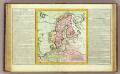
Suede, Dannemarck, Norwege.
1 : 8500000 Clouet, J. B. L. (Jean-Baptiste Louis), b. 1730
Nordeuropa 1814
Nordeuropa Kunz, Andreas ; Treiling, Thomas
Statistikk 42: Døgnets normaltemperatur i Skandinavia, juli måned
1 : 4000000